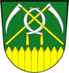
Chotěbuz
| Chotěbuz Kocobędz | |||
|---|---|---|---|
| Village | |||
 | |||
| |||
 | |||
| Coordinates: 49°46′10″N 18°35′10″E / 49.76944°N 18.58611°E | |||
| Country | Czech Republic | ||
| Region | Moravian-Silesian | ||
| District | Karviná | ||
| First mentioned | 1229 | ||
| Government | |||
| • Mayor | Martin Pinkas | ||
| Area | |||
| • Total | 10.61 km2 (4.10 sq mi) | ||
| Elevation | 330 m (1,080 ft) | ||
| Population (2006) | |||
| • Total | 1,088 | ||
| • Density | 100/km2 (270/sq mi) | ||
| Postal code | 735 61 | ||
| Website | http://www.chotebuz.cz/ | ||

![]() Chotěbuz (help·info) (Polish: Kocobędz , German: Kotzobendz) is a village in Karviná District, Moravian-Silesian Region of the Czech Republic. It lies on the border with Poland, on the left bank of the Olza River, in the historical region of Cieszyn Silesia. It has 1,033 inhabitants (2001 census), 21.3% of the population are the Poles.[1]
Chotěbuz (help·info) (Polish: Kocobędz , German: Kotzobendz) is a village in Karviná District, Moravian-Silesian Region of the Czech Republic. It lies on the border with Poland, on the left bank of the Olza River, in the historical region of Cieszyn Silesia. It has 1,033 inhabitants (2001 census), 21.3% of the population are the Poles.[1]
History
The village is one of the oldest in Cieszyn Silesia. It was first mentioned in the document of Pope Gregory IX issued for Benedictine abbey in Tyniec in 1229 as Koczobontz.[2][3] Politically it belonged then to the Duchy of Opole and Racibórz, and since 1290 to the Duchy of Teschen. It was also a property of Benedictine monastery in Orłowa founded around 1268. However, there was a fortified settlement (gród) of the Golensizi tribe in this place called Cieszynisko (or Old Cieszyn). It was an important center since the 8th century. After decline of the settlement at the beginning of the 12th century, it was relocated to Wzgórze Zamkowe (castle hill) in Cieszyn. Near the old place a new settlement was created, Podobora. It is today an archaeological site and was partly rebuilt to form archeopark which is possible to visit.
Remains of an old Gothic fort from the 13th century still remain, in its vicinity a Renaissance fort was later built. It was eventually rebuilt into a château at the beginning of the 19th century by the new owner. The Château gained its current look in 1875-1879, when it was completely rebuilt. It was again renovated in 1947.
From 1974 to 1997 Chotěbuz was administratively a part of Český Těšín.
There is a border crossing with Poland in the village, one of the largest in the country and the largest between the Czech Republic and Poland. It is connected with the Polish one by the long bridge built in 1991 running along the Olza River.
Gallery
-
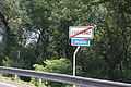
Bilingual signs at village limits
Footnotes
- ↑ "2001 census data". Czech Statistical Office.
- ↑ Hosák et al. 1970, 323.
- ↑ Panic, Idzi (2010). Śląsk Cieszyński w średniowieczu (do 1528) [Cieszyn Silesia in Middle Ages (until 1528)] (in Polish). Cieszyn: Starostwo Powiatowe w Cieszynie. p. 286. ISBN 978-83-926929-3-5.
References
- Cicha, Irena; Kazimierz Jaworski, Bronisław Ondraszek, Barbara Stalmach and Jan Stalmach (2000). Olza od pramene po ujście. Český Těšín: Region Silesia. ISBN 80-238-6081-X.
- Hosák, Ladislav; and Rudolf Šrámek (1970). Místní jména na Moravě a ve Slezsku I, A-L. Praha: Academia.
External links
- (Czech) Official website
| Wikimedia Commons has media related to Chotěbuz. |
| ||||||||


Coordinates: 49°46′10″N 18°35′10″E / 49.76944°N 18.58611°E