Chino, Nagano
From Wikipedia, the free encyclopedia
| Chino 茅野市 | ||
|---|---|---|
| City | ||
 | ||
| ||
 | ||
 Chino | ||
| Coordinates: 36°0′N 138°10′E / 36.000°N 138.167°ECoordinates: 36°0′N 138°10′E / 36.000°N 138.167°E | ||
| Country | Japan | |
| Region | Chūbu (Kōshin'etsu) | |
| Prefecture | Nagano Prefecture | |
| Government | ||
| • Mayor | Chiyokazu Yanagidaira (since April 2007) | |
| Area | ||
| • Total | 266.41 km2 (102.86 sq mi) | |
| Population (February 1, 2012) | ||
| • Total | 56,082 | |
| • Density | 210/km2 (550/sq mi) | |
| Time zone | Japan Standard Time (UTC+9) | |
| Symbols | ||
| - Tree | Betula platyphylla | |
| - Flower | Gentiana scabra | |
| Address |
2-6-1 Tsukahara-cho, Chino-shi, Nagano-ken 391-8501 | |
| Phone number | 0266-72-2101 | |
| Website | www.city.chino.nagano.jp | |
Chino (茅野市 Chino-shi) is a city in Nagano Prefecture, Japan. The city was founded on August 1, 1958.[citation needed]
As of February 1, 2012, the city has an estimated population of 56,082, with 21,904 households and a population density of 210.51 persons per km². The total area is 266.41 km².
Geography
Mountains
- Mount Yatsugatake
- Mount Tateshina
- Mount Kirigamine
Lakes

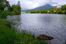
Lake Shirakaba
- Lake Shirakaba
- Lake Tateshina
Adjacent municipalities
Transport
Rail
Road
Education
Primary schools
- Izumino Primary school
- Kanazawa Primary school
- Eimei Primary school
- Miyagawa Primary school
- Kitayama Primary school
- Kohigashi Primary school
- Tamagawa Primary school
- Yonezawa Primary school
- Toyohira Primary school
Junior high schools
- Chino-Hokubu
- Chino-Eimei
- Chino-Nagamine
- Chino-Tōbu
High schools
- Nagano Prefecture Chino High School
- Tokai University Daisan Senior High School
Universities
Sightseeing
- Suwa Taisha
External links
| Wikimedia Commons has media related to Chino, Nagano. |
- Official website (Japanese)
| |||||||||||
This article is issued from Wikipedia. The text is available under the Creative Commons Attribution/Share Alike; additional terms may apply for the media files.
