Chinawal
| Chinawal चिनावल | |
|---|---|
| Village | |
 | |
 Chinawal | |
| Coordinates: 21°11′47″N 75°55′34″E / 21.1964°N 75.9261°ECoordinates: 21°11′47″N 75°55′34″E / 21.1964°N 75.9261°E | |
| Country |
|
| State | Maharashtra |
| District | Jalgaon district |
| Area | |
| • Total | 1.05 km2 (0.41 sq mi) |
| Elevation | 246 m (807 ft) |
| Population (2001) | |
| • Total | 11,049[1] |
| • Density | 11,000/km2 (30,000/sq mi) |
| Languages | |
| • Official | Marathi |
| Time zone | IST (UTC+5:30) |
| PIN | 425505 |
| Telephone code | 91-2584 |
| Vehicle registration | MH-19 |
| Sex ratio | 975 ♂/♀ |
| Literacy | 71%% |
Chinawal (village code 526909) is a village in the tehsil of Raver (sub-district code 03962) in Jalgaon district (district code 499) of Maharashtra state (state code 27) of India.[2] Jalgaon district and hence Chinawal village is known for banana production.[3] Apart from banana production, Chinawal village is known for primary, middle and high school educational facilities.
Geography and Geology
Chinawal village is located at 21°11′46″N 75°55′36″E / 21.1962°N 75.9267°E. It has an average elevation of 246 metres (810 feet) from sea level.[4] Chinawal is situated at foothills of Satpura range which is in north-east region of Deccan Traps and Khandesh. Landscape surrounding village is approximately flat, free of dikes and hills. The loam to clayey soil is of volcanic origin which contain poor to moderate organic carbon and nitrogen, poor amount of phosphorus and high to very high amount of potassium. Level of soil salinity and alkalinity is very low, hence non-agricultural land is almost non-existent.[5] As banana contains high level of potassium hence soil is ideal for banana crop production.
Demographics

As per 2001 census population of Chinawal village is 11049. Village has total 2289 households with 5791 males and 5258 females.[6] Average literacy rate of village is 71%. 77% males are literate and 65% females are literate. The distance between east end(21.196868E, 75.931079N) and west end(21.194194E, 75.919507N) is 1.231 km while the distance between north end(21.200548E, 75.925197N) and south end(21.192726E, 75.925363N) is 0.869 km. Hence total land area of village is approx 1.05 square km and hence density of population is approx 11000 per square km.
Climate


As Jalgaon city is just 50 km away and is at approximately same elevation as Chinawal village, climate of Chinawal village is same as Jalgaon city.
The temperature of Chinawal village remains hot for most of the year. Maximum temperature can reach up to 45°C in summer and minimum temperature can fall up to 10°C in the winter. Chinawal village receives average 784 mm rainfall in a year. As on whole, the climate of Chinawal remains dry and hot except during the monsoon season and winter months December to February. The seasons of year are divided into four parts. The cold winter season from December month to February month. Hot and dry season from March month to June month. The south-west monsoon season starts from around 15 June and last up to third week of September month. The post-monsoon season October month and November month remains hot and dry.
Due to hot weather, traditional clothes of farmers are of white color as white color reflects most of heat.
Chinawal is located at 21°11′47″N 75°55′35″E / 21.1963°N 75.9264°E. Hence Sun comes directly overhead on 27 May and 17 July every year. In leap year, date may change by one day.[7]
| Chinawal | ||||||||||||||||||||||||||||||||||||||||||||||||||||||||||||
|---|---|---|---|---|---|---|---|---|---|---|---|---|---|---|---|---|---|---|---|---|---|---|---|---|---|---|---|---|---|---|---|---|---|---|---|---|---|---|---|---|---|---|---|---|---|---|---|---|---|---|---|---|---|---|---|---|---|---|---|---|
| Climate chart (explanation) | ||||||||||||||||||||||||||||||||||||||||||||||||||||||||||||
| ||||||||||||||||||||||||||||||||||||||||||||||||||||||||||||
| ||||||||||||||||||||||||||||||||||||||||||||||||||||||||||||
| Climate data for Chinawal | |||||||||||||
|---|---|---|---|---|---|---|---|---|---|---|---|---|---|
| Month | Jan | Feb | Mar | Apr | May | Jun | Jul | Aug | Sep | Oct | Nov | Dec | Year |
| Average high °C (°F) | 30.4 (86.7) |
32.7 (90.9) |
37.5 (99.5) |
40.9 (105.6) |
42.5 (108.5) |
37.8 (100) |
31.4 (88.5) |
31.4 (88.5) |
31.6 (88.9) |
34.1 (93.4) |
31.8 (89.2) |
29.8 (85.6) |
34.33 (93.78) |
| Average low °C (°F) | 12.6 (54.7) |
14.3 (57.7) |
18.6 (65.5) |
24.1 (75.4) |
27.2 (81) |
26.1 (79) |
23.9 (75) |
23.5 (74.3) |
22.8 (73) |
19.2 (66.6) |
14.5 (58.1) |
11.9 (53.4) |
19.89 (67.81) |
| Precipitation mm (inches) | 8.9 (0.35) |
3.1 (0.122) |
4.1 (0.161) |
0 (0) |
10.7 (0.421) |
128.8 (5.071) |
249.7 (9.831) |
164.1 (6.461) |
148.6 (5.85) |
37.3 (1.469) |
22.1 (0.87) |
7.4 (0.291) |
784.8 (30.897) |
| Source: Jalgaon Weather | |||||||||||||
Economy
-

Skyline of Chinawal village farms.
-

Pic of dug well site in between farms
-

Farms with banana plantation in Chinawal village
-

Pic of one of banana farms for which Chinawal village is known.
-

Banana bunches in banana farm at Chinawal ready for sale
Occupation of most of villagers is Agriculture. Main crops grown by farmers are banana and cotton.[8] Other crops grown are wheat, jowar, bajra, Maize (corn), Mung bean (green gram), Sugarcane, Guar, Arhar or Tur, Pigeon pea, Urad (black gram), Peanut (groundnut) and other cereals, vegetables. Kharif crop is harvested during monsoon season. Water to Rabi crop is provided by Garbaldi dam and dug wells and drilled wellss. Drip irrigation is extensively used to conserve water. Farmers use tractors and bullock carts to carry out farm related works.
Other occupation of villagers is Retail stores, service and repair, healthcare, hotels, tobacco selling etc.
Chinawal village has bank branches of government-owned Central Bank of India and Jalgaon District Central Co-operative Bank.
Education
-

Zila Parishad Boys' Primary School(est.18 March 1865) in Chinawal village
-

Zila Parishad Girls' Primary School(est.18 March 1865) in Chinawal village
-

Building number 2 of Nutan Madhyamik Vidyalaya
-

Educational and cultural hall for students of Nutan Madhyamik Vidyala
-

Nutan Prathamik Vidya Mandir(est.1986) for primary education
-

Gate of Industrial Training Institute and Nutan English Medium school campus
-

Industrial Training Institute and Nutan English Medium school campus on Chinawal-Rozoda road
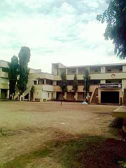
There are two schools for primary education up to 4th standard in Marathi language medium: zila parishad boys school and zila parishad girls school. Primary education through English language medium is provided by Nutan Prathamik Vidya Mandir school. Education from 5th standard to 12th standard, HSC is provided by Nutan Madhyamik Vidyalaya. Shikshan Prasarak Mandal has own School Buses to carry students from and to nearby villages. Accommodation is provided to students from nearby small villages, hamlets through boys' hostel and girls' hostel. All these educational facilities and hostels are located within 175 meter radius of 21°11′44″N 75°55′35″E / 21.195693°N 75.926282°E.
Industrial training institute is recently started. Work on proposed D.Ed. college is in progress.
Except Zila Parishad primary schools, all educational facilities are run by Shikshan Prasarak Mandal, Chinawal.[9]
Nearest college for Graduation and post-Graduation courses is Dhanaji Nana College at Faizpur which is 7 km away.
Transport and Communication
-

Road between Chinawal and nearby Rozoda village
-

Bus and auto rickshaw stand in Chinawal village
-

Reliance cellphone tower in Chinawal village
Chinawal village is well connected to nearby villages and cities through MSRTC buses and Auto rickshaws. Chinawal is connected to surrounding villages/cities through 7 roads which are Chinawal-Waghoda road, Chinawal-Kochur road, Chinawal-Rozoda road, Chinawal-Khiroda road, Chinawal-Savkheda road, Chinawal-Kumbharkheda road and Chinawal-Vadgaon road. Shahada - Raver Maharashtra State High Way Number 4 is 3 km south of Chinawal village near Waghoda village. Nearest railway station is 30 km away at Bhusawal city. Tahsil place Raver is 12 km and district place Jalgaon is around 50 km from village. Chinawal village is around 400 km North-East from state capital Mumbai. Being small village no lodging is available at village. Nearest town for lodging is Savda which is 6 km away from village.
Chinawal village has both landline and wireless telephone facilities. There are cellphone towers of major mobile companies like AirTel, Vodafone, BSNL, Idea, Reliance, Tata situated in Chinawal village. Internet connectivity is available through landline phone and wireless GPRS.
General info
-

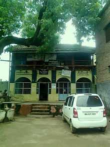
One of oldest temple in Chinawal village, Ram Mandir
-

Another oldest temple, Maruti Mandir, in Chinawal village
-

Muslim prayer place Masjid in Chinawal village
-

Shiv Mandir, known as 'langdebaba place' in Chinawal village
-

Muslim worshipped mausoleum, known as pirbaba/piloba, in Chinawal village
-

Hanuman Mandir in Chinawal village
-

Primary Health Center in Chinawal village run by State Government
-

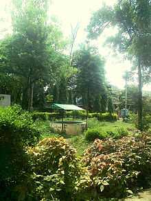
Devi temple in Garden of ZP Girls' Primary School, Chinawal
- Native languages of villagers are Khandeshi language, Marathi language and Hindi language.
- Traditional food of villagers is Thecha (Mix of Garlic and Green chilies), Bhakari (flat white millet bread), aachaar. Popular food include wange bharit(Baingan Barthaor roasted eggplant/aubergine preparation), Udchali dal (Urid Daal), Shev Bhaji, and spicy mutton. On occasions of festivals and weddings varan, poli, wange bhaji form basic part of dishes. In general most of Maharashtrian cuisine is part of villager's dishes.
- Chinawal village is situated at foothills of Satpura range. All land up to Satpura mountains is Agricultural. Green farms and blue mountains add to scenic beauty especially during monsoon.
- Village has Primary Health Centre and ambulance run by state government. But village has no private hospital with modern facilities and no MBBS Doctor for health emergency treatment.
- Ram Mandir, Maruti Mandir, Masjid are oldest prayer places in Chinawal village
- Chinawal village has no Cinema theatre. Main source of entertainment is Television. Most of houses has TV sets with cable and satellite dish.
- Nearest hill station 'Pal' is 25 km away situated in Satpura range.[10]
References
| Wikimedia Commons has media related to Chinawal. |
- ↑ http://www.censusindia.gov.in/PopulationFinder/Sub_Districts_Master.aspx?state_code=27&district_code=03
- ↑ http://www.onefivenine.com/india/villages/Jalgaon/Raver/Chinawal
- ↑ http://articles.economictimes.indiatimes.com/2008-03-12/news/27695570_1_banana-exports-maharashtra-jalgaon-district
- ↑ http://veloroutes.org/elevation/?location=Chinawal&units=m
- ↑ http://www.cabdirect.org/abstracts/20113040100.html;jsessionid=E7364E5E1051F988A2F4B900D5D62993
- ↑ http://censusindia.gov.in/PopulationFinder/View_Village_Population.aspx?pcaid=574823&category=VILLAGE
- ↑ http://www.wsanford.com/~wsanford/exo/sundials/DEC_Sun.html
- ↑ http://jalgaon.nic.in/html/district_at_a_glance.htm
- ↑ http://spmchinawal.org
- ↑ http://www.india9.com/i9show/Pal-Hill-Station-50701.htm
| ||||||||||||||||||||||||||||||||||||||||