Castignano
From Wikipedia, the free encyclopedia
| Castignano | |
|---|---|
| Comune | |
| Comune di Castignano | |
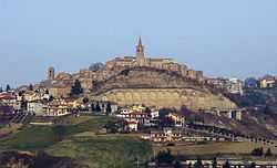 | |
 Castignano | |
| Coordinates: 42°56′N 13°37′E / 42.933°N 13.617°ECoordinates: 42°56′N 13°37′E / 42.933°N 13.617°E | |
| Country | Italy |
| Region | Marche |
| Province | Province of Ascoli Piceno (AP) |
| Frazioni | Ripaberarda, San Venanzo, San Martino, Castiglioni, Rufiano, Sant'Angelo di Ripaberarda |
| Area | |
| • Total | 38.9 km2 (15.0 sq mi) |
| Elevation | 473 m (1,552 ft) |
| Population (Dec. 2004) | |
| • Total | 3,039 |
| • Density | 78/km2 (200/sq mi) |
| Demonym | Castignanesi |
| Time zone | CET (UTC+1) |
| • Summer (DST) | CEST (UTC+2) |
| Postal code | 63032 |
| Dialing code | 0736 |
| Website | Official website |
Castignano is a comune (municipality) in the Province of Ascoli Piceno in the Italian region Marche, located about 80 km south of Ancona and about 10 km northeast of Ascoli Piceno. As of 31 December 2004, it had a population of 3,039 and an area of 38.9 km².[1]
The municipality of Castignano contains the frazioni (subdivisions, mainly villages and hamlets) Ripaberarda, San Venanzo, San Martino, Castiglioni, Rufiano, and Sant'Angelo di Ripaberarda.
Castignano borders the following municipalities: Appignano del Tronto, Ascoli Piceno, Cossignano, Montalto delle Marche, Montedinove, Offida, Rotella.
Demographic evolution

References
External links
This article is issued from Wikipedia. The text is available under the Creative Commons Attribution/Share Alike; additional terms may apply for the media files.