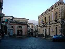
Castiglione di Sicilia

| Castiglione di Sicilia | |
|---|---|
| Comune | |
| Comune di Castiglione di Sicilia | |
 Castiglione di Sicilia | |
| Coordinates: 37°53′N 15°7′E / 37.883°N 15.117°ECoordinates: 37°53′N 15°7′E / 37.883°N 15.117°E | |
| Country | Italy |
| Region | Sicily |
| Province | Province of Catania (CT) |
| Frazioni | Gravà, Mitogio, Passopisciaro, Rovittello, Solicchiata, Verzella, Castrorai |
| Area | |
| • Total | 120.5 km2 (46.5 sq mi) |
| Elevation | 621 m (2,037 ft) |
| Population (Dec. 2004) | |
| • Total | 3,574 |
| • Density | 30/km2 (77/sq mi) |
| Demonym | Castiglionesi |
| Time zone | CET (UTC+1) |
| • Summer (DST) | CEST (UTC+2) |
| Postal code | 95012 |
| Dialing code | 0942 |
| Website | Official website |
Castiglione di Sicilia (Sicilian: Castigghiuni di Sicilia) is a comune (municipality) in the Province of Catania in Sicily.
Geography
Castiglione di Sicilia lies about 160 km east of Palermo and about 40 km north of Catania. As of 31 December 2004, it had a population of 3,574 and an area of 120.5 km².[1] It borders the following municipalities: Adrano, Belpasso, Biancavilla, Bronte, Calatabiano, Francavilla di Sicilia, Gaggi, Graniti, Linguaglossa, Maletto, Malvagna, Mojo Alcantara, Motta Camastra, Nicolosi, Piedimonte Etneo, Randazzo, Roccella Valdemone, Sant'Alfio, Taormina, Zafferana Etnea.
Frazioni
The municipality of Castiglione di Sicilia contains the frazioni (subdivisions, mainly villages and hamlets) Gravà, Mitogio, Passopisciaro, Rovittello, Solicchiata, Verzella and Castrorai.
Gravà
Mitogio
Passopisciaro
Passopisciaro is situated 12 km from Castiglione di Sicilia, at 645m above sea level on the northern slopes of Mt. Etna. Nowadays Passopisciaro has a population of about 500 but in years gone by the population was as high as 1500 people. The village can be reached by taking the SS120 Roman road from Fiumefreddo di Sicilia, or by the Circumetnea Railway. Passopisciaro's main industry is wine making, vineyards can be found scattered throughout the entire region.
Rovittello
Solicchiata
Verzella
Castrorari
Demographic evolution
