Carney Island
From Wikipedia, the free encyclopedia
 | |
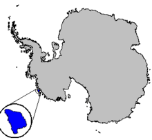
 Location of Carney Island | |
| Geography | |
|---|---|
| Location | Antarctica |
| Coordinates | 73°57′S 121°00′W / 73.950°S 121.000°WCoordinates: 73°57′S 121°00′W / 73.950°S 121.000°W |
| Area | 8,500 km2 (3,300 sq mi) |
| Area rank | 86th |
| Length | 110 km (68 mi) |
| Country | |
|
Antarctica | |
Carney Island (73°57′S 121°00′W / 73.950°S 121.000°W) is an ice-covered island, 110 km (68 mi) long and about 8,500 km2 (3,282 sq mi) in area, with all but its North coast lying within the Getz Ice Shelf, Antarctica. It is located between Siple Island and Wright Island along the coast of Marie Byrd Land.
Carney Island was named by the United States Advisory Committee on Antarctic Names (US-ACAN) for Admiral Robert Carney (1895–1990), Chief of Naval Operations during the organization of Operation Deep Freeze support for the International Geophysical Year of 1957–1958.
See also
- Composite Gazetteer of Antarctica
- List of Antarctic and subantarctic islands
- List of Antarctic islands south of 60° S
- Scientific Committee on Antarctic Research
- Territorial claims in Antarctica
References
This article is issued from Wikipedia. The text is available under the Creative Commons Attribution/Share Alike; additional terms may apply for the media files.