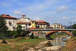
Carcare
From Wikipedia, the free encyclopedia
| Carcare | ||
|---|---|---|
| Comune | ||
| Comune di Carcare | ||
 | ||
| ||
 Carcare | ||
| Coordinates: 44°22′N 8°17′E / 44.367°N 8.283°E | ||
| Country | Italy | |
| Region | Liguria | |
| Province | Savona (SV) | |
| Frazioni | Vispa | |
| Government | ||
| • Mayor | Franco Bologna | |
| Area | ||
| • Total | 10.4 km2 (4.0 sq mi) | |
| Population (31 December 2008[1]) | ||
| • Total | 5,688 | |
| • Density | 550/km2 (1,400/sq mi) | |
| Demonym | Carcaresi | |
| Time zone | CET (UTC+1) | |
| • Summer (DST) | CEST (UTC+2) | |
| Postal code | 17043 | |
| Dialing code | 019 | |
Carcare is a comune (municipality) in the Province of Savona in the Italian region Liguria, located about 50 km west of Genoa and about 20 km northwest of Savona.
Carcare borders the following municipalities: Altare, Cairo Montenotte, Cosseria, Mallare, Pallare, and Plodio.
The church of St. John the Baptist houses a 17th-century Crucifix by Anton Maria Maragliano. Of the 16th-century castle, only ruins remain today.
References
This article is issued from Wikipedia. The text is available under the Creative Commons Attribution/Share Alike; additional terms may apply for the media files.
