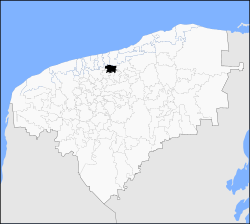
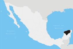
Cansahcab Municipality
| Cansahcab | |
|---|---|
| Municipality | |
 | |
 Cansahcab | |
| Coordinates: 21°10′N 89°06′W / 21.167°N 89.100°WCoordinates: 21°10′N 89°06′W / 21.167°N 89.100°W | |
| Country |
|
| State |
|
| Government | |
| • Type |
|
| • Municipal President[1] | Paulino Ek Chan |
| Area | |
| • Total | 146.9 km2 (56.7 sq mi) |
| [1] | |
| Elevation[1] | 6 m (20 ft) |
| Population (2005 [2][3]) | |
| • Total | 4,738 |
| Time zone | Central Standard Time (UTC-6) |
| • Summer (DST) | Central Daylight Time (UTC-5) |
| INEGI Code | 009 |
| Major Airport | Merida (Manuel Crescencio Rejón) International Airport |
| IATA Code | MID |
| ICAO Code | MMMD |
| Website | Official Website |
Cansahcab (In the Yucatec Maya Language: “Place of the four white caves”) is a small (146.90 km²)[1] municipality in the Mexican state of Yucatan located roughly 50 km southeast of the Merida. The population of Cansahcab is between 4500 and 5000,[1] with much of its adult male population working in the United States. Economic activity in Cansahcab is quite minimal; the town subsists largely on remittances sent by family members working abroad.[citation needed]
Communities
The municipality is made up of 10 communities, the most significant of which include:[1]
- Cansahcab (Municipal Seat)
- Santa María
- San Antonio Xiat
Local Festivals
Every year from September 14 – 16th Cansahcab holds an annual fair or “fiesta del pueblo” during which an impromptu bullfighting ring is set up to host much of the festivities which include a charrería, bullfighting and folkloric dancing.
Notables
Notable locals include General Teodosio Canto who was governor of the state of Yucatan from 1882-1886.[1]
External links
References
- ↑ 1.0 1.1 1.2 1.3 1.4 1.5 1.6 "Nuestros municipios - Cansahcab". Retrieved 2009-11-13.
- ↑ "Encyclopedia of the Municipalities of Mexico: Yucatan". Retrieved 2009-11-01.
- ↑ Census Results by Locality, 2005 INEGI.
| |||||||||||||||||||||||
