Campbellsburg, Kentucky
| Campbellsburg, Kentucky | |
|---|---|
| City | |
 | |
| Coordinates: 38°31′23″N 85°12′16″W / 38.52306°N 85.20444°WCoordinates: 38°31′23″N 85°12′16″W / 38.52306°N 85.20444°W | |
| Country | United States |
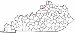
| State | Kentucky |
| County | Henry |
| Government | |
| • Mayor | Rex W. Morgan |
| Area | |
| • Total | 0.6 sq mi (1.5 km2) |
| • Land | 0.6 sq mi (1.5 km2) |
| • Water | 0.0 sq mi (0.0 km2) |
| Elevation | 906 ft (276 m) |
| Population (2010) | |
| • Total | 807 |
| • Density | 1,246.3/sq mi (481.2/km2) |
| Time zone | Eastern (EST) (UTC-5) |
| • Summer (DST) | EDT (UTC-4) |
| ZIP code | 40011 |
| Area code(s) | 502 |
| FIPS code | 21-12142 |
| GNIS feature ID | 0488741 |
Campbellsburg is a 5th-class city in Henry County, Kentucky, in the United States. The population was 807 at the 2010 census. It is home to Post 5 of the Kentucky State Police.
The city was incorporated by the state legislature in 1840 as Chiltonsville (in honor of its trustee Charles J. Chilton) but the name was changed within three weeks to Campbellsburg for another local family. Later the same year, the local post office at Benevola was renamed to Campbellsburg as well. The arrival of the Louisville, Cincinnati, & Lexington railroad in 1869 led to a division of the town into Old and New Campbellsburg. The later was separately incorporated in 1876 but eventually expanded until the two polities merged into the present town.[1]
Geography
Campbellsburg is located at 38°31′23″N 85°12′16″W / 38.52306°N 85.20444°W (38.523111, -85.204391)[2].
According to the United States Census Bureau, the city has a total area of 0.6 square miles (1.6 km2), of which 0.6 square miles (1.6 km2) is land and 1.72% is water.
Demographics
As of the census[3] of 2010, there were 807 people, 283 households, and 202 families residing in the city. The population density was 1,246.3 people per square mile (477.5/km²). There were 298 housing units at an average density of 526.8 per square mile (201.9/km²). The racial makeup of the city was 94.75% White, 3.83% African American, 0.85% Asian, 0.43% from other races, and 0.14% from two or more races. Hispanic or Latino of any race were 1.28% of the population.
There were 283 households out of which 32.2% had children under the age of 18 living with them, 51.6% were married couples living together, 18.7% had a female householder with no husband present, and 28.6% were non-families. 26.9% of all households were made up of individuals and 15.9% had someone living alone who was 65 years of age or older. The average household size was 2.49 and the average family size was 3.01.
In the city the population was spread out with 27.4% under the age of 18, 7.9% from 18 to 24, 25.5% from 25 to 44, 23.3% from 45 to 64, and 15.9% who were 65 years of age or older. The median age was 36 years. For every 100 females there were 84.6 males. For every 100 females age 18 and over, there were 77.2 males.
The median income for a household in the city was $35,865, and the median income for a family was $41,406. Males had a median income of $31,250 versus $21,250 for females. The per capita income for the city was $15,755. About 10.5% of families and 18.1% of the population were below the poverty line, including 22.6% of those under age 18 and 19.5% of those age 65 or over.
References
- ↑ Rennick, Robert M. Kentucky Place Names. The University Press of Kentucky (Lexington), 1988. ISBN 0-8131-0179-4.
- ↑ "US Gazetteer files: 2010, 2000, and 1990". United States Census Bureau. 2011-02-12. Retrieved 2011-04-23.
- ↑ "American FactFinder". United States Census Bureau. Retrieved 2008-01-31.
| |||||||||||||||||
