Burhaniye
| Burhaniye | ||
|---|---|---|
| Town | ||
| ||
 | ||
 Burhaniye | ||
| Coordinates: 39°30′N 26°57′E / 39.500°N 26.950°ECoordinates: 39°30′N 26°57′E / 39.500°N 26.950°E | ||
| Country |
| |
| Region | Aegean | |
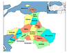
| Province | Balıkesir | |
| Government | ||
| • Mayor | Fikret Akova (CHP) | |
| Area[1] | ||
| • District | 279.96 km2 (108.09 sq mi) | |
| Population (2012)[2] | ||
| • Urban | 41,918 | |
| • District | 52,787 | |
| • District Density | 190/km2 (490/sq mi) | |
| Time zone | EET (UTC+2) | |
| • Summer (DST) | EEST (UTC+3) | |
| Area code(s) | 266 | |
| Licence plate | 10 | |
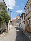
Burhaniye is a coastal town and district of Balıkesir Province in the Aegean region of Turkey. The district is located on the Aegean coast and is known for its olive oil.
Burhaniye has a port and a museum of archeology and Turkish national movement. Every second July is Ören Tourism and Art Festival.
History
Burhaniye was founded as Taylıeli Köyü ('Town of Taylı'), named after one of the lords who came to the aid of Seljuk Turkish bey Süleyman Bey . At the beginning of the 14th century it came under the domain of the Karasids and grew as it attracted migrants. In Ottoman times, it was also known as Kemer and attached to Edremit until 1866 and became the centre of a district named after itself. It was renamed Burhaniye after the Ottoman Prince Şehzade Burhanettin. In 29 June 1920, it was occupied by the Greek army who set fire to the town and destroyed the town's main mosque before retreating.
Gallery
-

lÖren Beach, Burhaniye
-

Burhaniye Museum
-

Sister towns of Burhaniye
See also
References
| Wikimedia Commons has media related to Burhaniye, Balıkesir. |
- ↑ "Area of regions (including lakes), km²". Regional Statistics Database. Turkish Statistical Institute. 2002. Retrieved 2013-03-05.
- ↑ "Population of province/district centers and towns/villages by districts - 2012". Address Based Population Registration System (ABPRS) Database. Turkish Statistical Institute. Retrieved 2013-02-27.
| ||||||||||||||||||||||||||||||||||||||||||||||||||||||