Burglengenfeld
From Wikipedia, the free encyclopedia
| Burglengenfeld | ||
|---|---|---|
| ||
 Burglengenfeld | ||
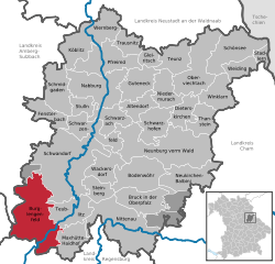
Location of Burglengenfeld within Schwandorf district  | ||
| Coordinates: 49°12′N 12°2′E / 49.200°N 12.033°ECoordinates: 49°12′N 12°2′E / 49.200°N 12.033°E | ||
| Country | Germany | |
| State | Bavaria | |
| Admin. region | Oberpfalz | |
| District | Schwandorf | |
| Subdivisions | 4 Stadtteile | |
| Government | ||
| • Mayor | Heinz Karg (SPD/"Freie Wähler-Burgl. Wählergem. e.V. ") | |
| Area | ||
| • Total | 93.28 km2 (36.02 sq mi) | |
| Elevation | 355 m (1,165 ft) | |
| Population (2012-12-31)[1] | ||
| • Total | 12,383 | |
| • Density | 130/km2 (340/sq mi) | |
| Time zone | CET/CEST (UTC+1/+2) | |
| Postal codes | 93133 | |
| Dialling codes | 0 94 71 | |
| Vehicle registration | SAD | |
| Website | www.burglengenfeld.de | |
Burglengenfeld is a town in the district of Schwandorf, in Bavaria, Germany. It is situated on the river Naab, 22 km north of Regensburg.
Climate
Climate in this area has mild differences between highs and lows, and there is adequate rainfall year round. The Köppen Climate Classification subtype for this climate is "Cfb". (Marine West Coast Climate/Oceanic climate).[2]
Anti-WAAhnsinns-Festival

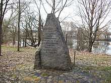
Anti-WAAhnsinns-Festival memorial stone in Burglengenfeld
The Anti-WAAhnsinns Festivals in Burglengenfeld were political rock concerts, which took place in Germany in the 1980s. Their purpose was to support protests against a planned nuclear reprocessing plant Wackersdorf (German: Wiederaufbereitungsanlage Wackersdorf, abbreviated WAA Wackersdorf) in Wackersdorf.
References
- ↑ "Fortschreibung des Bevölkerungsstandes". Bayerisches Landesamt für Statistik und Datenverarbeitung (in German). 31 December 2012.
- ↑ Climate Summary for closest city on record
This article is issued from Wikipedia. The text is available under the Creative Commons Attribution/Share Alike; additional terms may apply for the media files.
