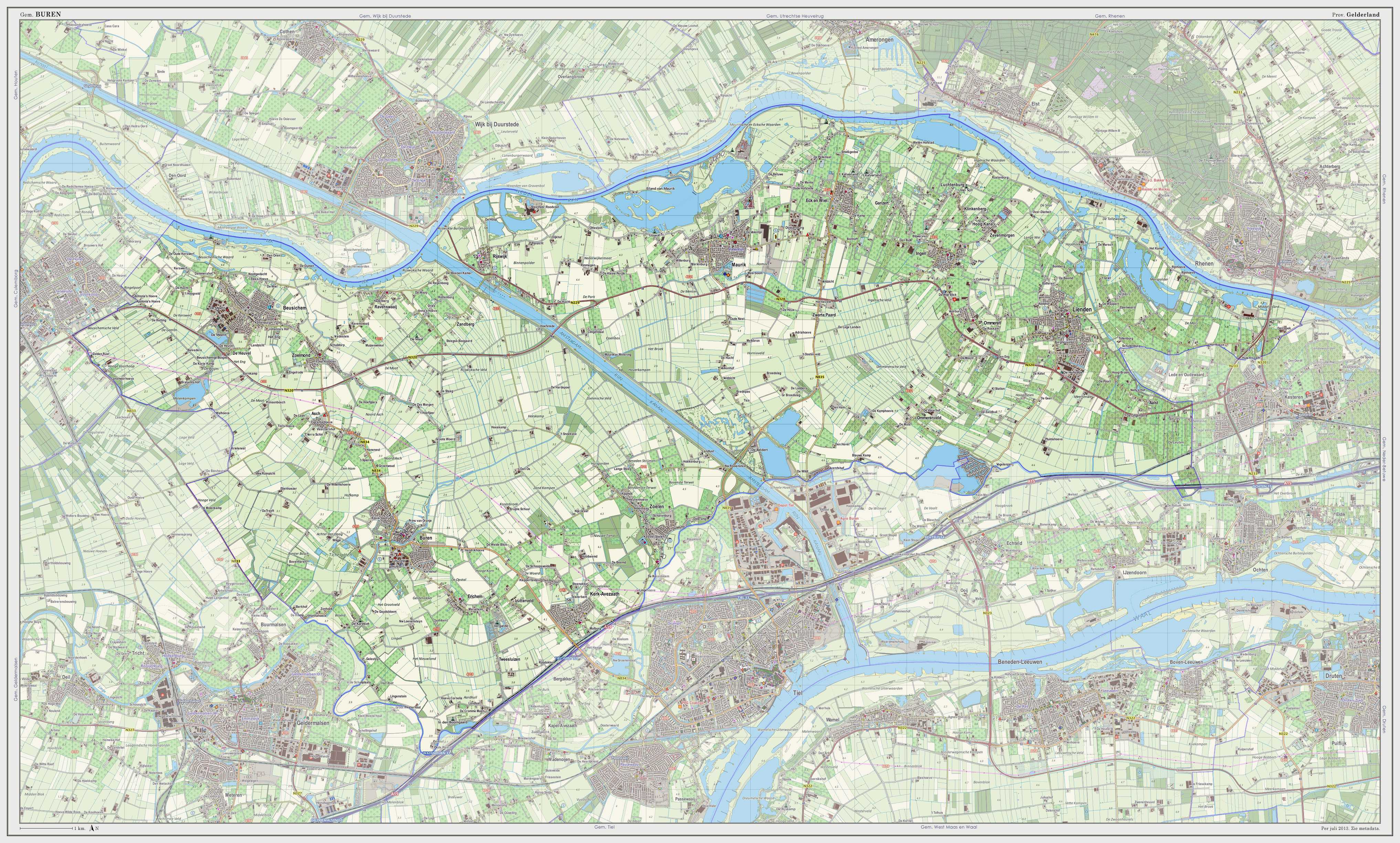
Buren
| Buren | |||
|---|---|---|---|
| Municipality | |||
 | |||
| |||
 | |||
| Coordinates: 51°58′N 05°25′E / 51.967°N 5.417°ECoordinates: 51°58′N 05°25′E / 51.967°N 5.417°E | |||
| Country | Netherlands | ||
| Province | Gelderland | ||
| Area(2006) | |||
| • Total | 142.93 km2 (55.19 sq mi) | ||
| • Land | 134.66 km2 (51.99 sq mi) | ||
| • Water | 8.27 km2 (3.19 sq mi) | ||
| Population (1 January 2007) | |||
| • Total | 25,644 | ||
| • Density | 190/km2 (500/sq mi) | ||
| Source: CBS, Statline. | |||
| Time zone | CET (UTC+1) | ||
| • Summer (DST) | CEST (UTC+2) | ||
 Buren (
![]() pronunciation (help·info)) is a municipality and a city in the Betuwe region in the Netherlands. It is also a historical county, with the Dutch Monarch still holding the title "Count of Buren".
pronunciation (help·info)) is a municipality and a city in the Betuwe region in the Netherlands. It is also a historical county, with the Dutch Monarch still holding the title "Count of Buren".
Geography
The river Korne flows through Buren.
Population centres
Population centers include:
The city of Buren
The earliest known reference to the settlement dates from 772.[1] The castle built by the Lords of Buren is first mentioned in 1298. The town was granted city rights in 1395 by Sir Alard IV of Buren, which led to the construction of a defensive wall and a moat. Significant parts of these still exist. In 1492 the region was promoted to a county (i.e. ruled by a count), but due to its isolated position it never became very important economically. By 1574 the previously Catholic parish church of Saint Lambert (Dutch: Sint Lambertus) had already become Calvinist Reformed Protestant.[citation needed]
The castle eventually came into the possession of the House of Orange, the later royal family of the Netherlands. One of King Willem-Alexander's titles is the Count of Buren. The Dutch Royals have been known to use the name van Buren in situations requiring anonymity. The castle was gradually demolished between 1804 and 1883.
Culture
Museums
Buren has two museums.
- Museum of the Royal Military Police Located in a 17th-century orphanage.
- Museum of the Dutch Royal Family (in Dutch) Located in the historic city hall.
Demographics
- Dutch: 92.9%
- Black people: 0.7%
- European: 4.7%
- Arabs: 0.5%
- Other non-Western: 1.2%:[2]
Gallery
-

The Culemborg gate with the Saint-Lambertus church (Buren) in the background.
-

Statue in the center of Buren - William of Orange and Anna van Buren.
-
Strollers in Buren - Herenstraat and the Rodeheldenstraat in the background.
-
Pulpit of the Saint Lambertus church in Buren.
-
Weigh scales and village pump on the market place in Buren.
See also
References
- ↑ Stenvert, R. et al. (2000). Monumenten in Nederland: Gelderland, p. 124–127. Zwolle: Waanders Uitgevers. ISBN 90-400-9406-3
- ↑
External links
| Wikimedia Commons has media related to Buren, Gelderland. |
- Official Website
 Chisholm, Hugh, ed. (1911). "Tiel". Encyclopædia Britannica (11th ed.). Cambridge University Press Contains a paragraph on Buren.
 |
Wijk bij Duurstede (UT), Utrechtse Heuvelrug (UT) Lek, Nederrijn |
Rhenen (UT) Nederrijn |
 | |
| Culemborg | |
Neder-Betuwe | ||
| ||||
| | ||||
| Geldermalsen | Tiel |


