Bucéels
From Wikipedia, the free encyclopedia
| Bucéels | |
|---|---|
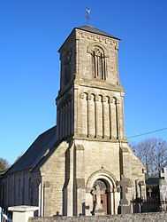 | |
 Bucéels | |
|
Location within Lower Normandy region  Bucéels | |
| Coordinates: 49°11′32″N 0°38′22″W / 49.1922°N 0.6394°WCoordinates: 49°11′32″N 0°38′22″W / 49.1922°N 0.6394°W | |
| Country | France |
| Region | Lower Normandy |
| Department | Calvados |
| Arrondissement | Bayeux |
| Canton | Balleroy |
| Intercommunality | Val de Seulles |
| Government | |
| • Mayor (2008–2014) | Marie-Thérèse Lemoine |
| Area | |
| • Land1 | 4.84 km2 (1.87 sq mi) |
| Population (2008) | |
| • Population2 | 390 |
| • Population2 Density | 81/km2 (210/sq mi) |
| INSEE/Postal code | 14111 / 14250 |
| Elevation |
42–96 m (138–315 ft) (avg. 150 m or 490 ft) |
|
1 French Land Register data, which excludes lakes, ponds, glaciers > 1 km² (0.386 sq mi or 247 acres) and river estuaries. 2 Population without double counting: residents of multiple communes (e.g., students and military personnel) only counted once. | |
Bucéels is a commune in the Calvados department in the Basse-Normandie region in northwestern France.
Population
| Historical population | ||
|---|---|---|
| Year | Pop. | ±% |
| 1962 | 185 | — |
| 1968 | 147 | −20.5% |
| 1975 | 151 | +2.7% |
| 1982 | 225 | +49.0% |
| 1990 | 357 | +58.7% |
| 1999 | 353 | −1.1% |
| 2008 | 390 | +10.5% |
See also
References
| Wikimedia Commons has media related to Bucéels. |
This article is issued from Wikipedia. The text is available under the Creative Commons Attribution/Share Alike; additional terms may apply for the media files.