Brossac
From Wikipedia, the free encyclopedia
| Brossac | |
|---|---|
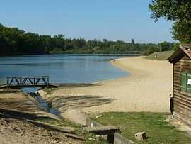 | |
 Brossac | |
|
Location within Poitou-Charentes region  Brossac | |
| Coordinates: 45°19′56″N 0°02′36″W / 45.3322°N 0.0433°WCoordinates: 45°19′56″N 0°02′36″W / 45.3322°N 0.0433°W | |
| Country | France |
| Region | Poitou-Charentes |
| Department | Charente |
| Arrondissement | Cognac |
| Canton | Brossac |
| Intercommunality | 3B - Sud-Charente |
| Government | |
| • Mayor (2008–2014) | Joseph Rousselière |
| Area | |
| • Land1 | 21.84 km2 (8.43 sq mi) |
| Population (2008) | |
| • Population2 | 535 |
| • Population2 Density | 24/km2 (63/sq mi) |
| INSEE/Postal code | 16066 / 16480 |
| Elevation |
75–184 m (246–604 ft) (avg. 159 m or 522 ft) |
|
1 French Land Register data, which excludes lakes, ponds, glaciers > 1 km² (0.386 sq mi or 247 acres) and river estuaries. 2 Population without double counting: residents of multiple communes (e.g., students and military personnel) only counted once. | |
Brossac is a commune in the Charente department in southwestern France.
Population
| Historical population | ||
|---|---|---|
| Year | Pop. | ±% |
| 1793 | 1,019 | — |
| 1800 | 1,017 | −0.2% |
| 1806 | 896 | −11.9% |
| 1821 | 1,073 | +19.8% |
| 1831 | 1,277 | +19.0% |
| 1841 | 1,154 | −9.6% |
| 1846 | 1,164 | +0.9% |
| 1851 | 1,168 | +0.3% |
| 1856 | 1,200 | +2.7% |
| 1861 | 1,163 | −3.1% |
| 1866 | 1,136 | −2.3% |
| 1872 | 1,066 | −6.2% |
| 1876 | 1,132 | +6.2% |
| 1881 | 1,167 | +3.1% |
| 1886 | 1,111 | −4.8% |
| 1891 | 987 | −11.2% |
| 1896 | 948 | −4.0% |
| 1901 | 906 | −4.4% |
| 1906 | 913 | +0.8% |
| 1911 | 961 | +5.3% |
| 1921 | 890 | −7.4% |
| 1926 | 933 | +4.8% |
| 1931 | 879 | −5.8% |
| 1936 | 899 | +2.3% |
| 1946 | 860 | −4.3% |
| 1954 | 832 | −3.3% |
| 1962 | 862 | +3.6% |
| 1968 | 778 | −9.7% |
| 1975 | 679 | −12.7% |
| 1982 | 635 | −6.5% |
| 1990 | 593 | −6.6% |
| 1999 | 525 | −11.5% |
| 2008 | 535 | +1.9% |
See also
References
External links
- Brossac - Stop Brossac Quarry
- Brossac Support group Forum Support against the ruination of the Brossac commune.
| Wikimedia Commons has media related to Brossac. |
This article is issued from Wikipedia. The text is available under the Creative Commons Attribution/Share Alike; additional terms may apply for the media files.