Brillac
From Wikipedia, the free encyclopedia
| Brillac | |
|---|---|
 | |
 Brillac | |
|
Location within Poitou-Charentes region  Brillac | |
| Coordinates: 46°03′41″N 0°46′42″E / 46.0614°N 0.7783°ECoordinates: 46°03′41″N 0°46′42″E / 46.0614°N 0.7783°E | |
| Country | France |
| Region | Poitou-Charentes |
| Department | Charente |
| Arrondissement | Confolens |
| Canton | Confolens-Sud |
| Intercommunality | Confolentais |
| Government | |
| • Mayor (2008–2014) | Jacky Martineau |
| Area | |
| • Land1 | 42.41 km2 (16.37 sq mi) |
| Population (2008) | |
| • Population2 | 638 |
| • Population2 Density | 15/km2 (39/sq mi) |
| INSEE/Postal code | 16065 / 16500 |
| Elevation |
143–246 m (469–807 ft) (avg. 220 m or 720 ft) |
|
1 French Land Register data, which excludes lakes, ponds, glaciers > 1 km² (0.386 sq mi or 247 acres) and river estuaries. 2 Population without double counting: residents of multiple communes (e.g., students and military personnel) only counted once. | |
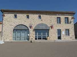
Brillac is a commune in the Charente department in southwestern France.
Population
| Historical population | ||
|---|---|---|
| Year | Pop. | ±% |
| 1793 | 1,630 | — |
| 1800 | 1,130 | −30.7% |
| 1806 | 1,507 | +33.4% |
| 1821 | 1,354 | −10.2% |
| 1831 | 1,598 | +18.0% |
| 1841 | 1,629 | +1.9% |
| 1846 | 1,680 | +3.1% |
| 1851 | 1,665 | −0.9% |
| 1856 | 1,638 | −1.6% |
| 1861 | 1,530 | −6.6% |
| 1866 | 1,573 | +2.8% |
| 1872 | 1,559 | −0.9% |
| 1876 | 1,636 | +4.9% |
| 1881 | 1,588 | −2.9% |
| 1886 | 1,600 | +0.8% |
| 1891 | 1,531 | −4.3% |
| 1896 | 1,542 | +0.7% |
| 1901 | 1,563 | +1.4% |
| 1906 | 1,596 | +2.1% |
| 1911 | 1,537 | −3.7% |
| 1921 | 1,318 | −14.2% |
| 1926 | 1,328 | +0.8% |
| 1931 | 1,205 | −9.3% |
| 1936 | 1,162 | −3.6% |
| 1946 | 1,092 | −6.0% |
| 1954 | 1,057 | −3.2% |
| 1962 | 953 | −9.8% |
| 1968 | 881 | −7.6% |
| 1975 | 786 | −10.8% |
| 1982 | 679 | −13.6% |
| 1990 | 613 | −9.7% |
| 1999 | 664 | +8.3% |
| 2008 | 638 | −3.9% |
See also
References
| Wikimedia Commons has media related to Brillac. |
This article is issued from Wikipedia. The text is available under the Creative Commons Attribution/Share Alike; additional terms may apply for the media files.