Bretteville-sur-Odon
From Wikipedia, the free encyclopedia
| Bretteville-sur-Odon | ||
|---|---|---|
 | ||
| ||
 Bretteville-sur-Odon | ||
|
Location within Lower Normandy region  Bretteville-sur-Odon | ||
| Coordinates: 49°10′14″N 0°24′46″W / 49.1706°N 0.4128°WCoordinates: 49°10′14″N 0°24′46″W / 49.1706°N 0.4128°W | ||
| Country | France | |
| Region | Lower Normandy | |
| Department | Calvados | |
| Arrondissement | Caen | |
| Canton | Caen-1 | |
| Intercommunality | Caen la Mer | |
| Government | ||
| • Mayor (2008–2014) | Pierre Estrade | |
| Area | ||
| • Land1 | 6.46 km2 (2.49 sq mi) | |
| Population (2008) | ||
| • Population2 | 4,060 | |
| • Population2 Density | 630/km2 (1,600/sq mi) | |
| INSEE/Postal code | 14101 / 14760 | |
| Elevation |
5–72 m (16–236 ft) (avg. 15 m or 49 ft) | |
|
1 French Land Register data, which excludes lakes, ponds, glaciers > 1 km² (0.386 sq mi or 247 acres) and river estuaries. 2 Population without double counting: residents of multiple communes (e.g., students and military personnel) only counted once. | ||

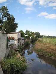
Bretteville-sur-Odon is a commune in the department of Calvados in the Basse-Normandie region in northwestern France. It lies on the river Odon, about 5 km (3.1 mi) west of Caen.
Population
| Historical population | ||
|---|---|---|
| Year | Pop. | ±% |
| 1793 | 544 | — |
| 1800 | 559 | +2.8% |
| 1806 | 618 | +10.6% |
| 1821 | 752 | +21.7% |
| 1831 | 756 | +0.5% |
| 1836 | 801 | +6.0% |
| 1841 | 804 | +0.4% |
| 1846 | 784 | −2.5% |
| 1851 | 803 | +2.4% |
| 1856 | 803 | +0.0% |
| 1861 | 817 | +1.7% |
| 1866 | 795 | −2.7% |
| 1872 | 758 | −4.7% |
| 1876 | 732 | −3.4% |
| 1881 | 737 | +0.7% |
| 1886 | 671 | −9.0% |
| 1891 | 634 | −5.5% |
| 1896 | 682 | +7.6% |
| 1901 | 556 | −18.5% |
| 1906 | 631 | +13.5% |
| 1911 | 651 | +3.2% |
| 1921 | 660 | +1.4% |
| 1926 | 652 | −1.2% |
| 1931 | 755 | +15.8% |
| 1936 | 726 | −3.8% |
| 1946 | 760 | +4.7% |
| 1954 | 1,807 | +137.8% |
| 1962 | 1,232 | −31.8% |
| 1968 | 2,182 | +77.1% |
| 1975 | 2,466 | +13.0% |
| 1982 | 3,326 | +34.9% |
| 1990 | 3,623 | +8.9% |
| 1999 | 3,951 | +9.1% |
| 2008 | 4,060 | +2.8% |
Twin towns
- Woodbury, Devon, UK since 1978
- Glattbach, Germany since 1987
- Ouonck CR, Sénégal since 1997
See also
References
| Wikimedia Commons has media related to Bretteville-sur-Odon. |
This article is issued from Wikipedia. The text is available under the Creative Commons Attribution/Share Alike; additional terms may apply for the media files.