Brentwood Town Centre
 | |
| Location | Burnaby, British Columbia, Canada |
|---|---|
| Opening date | August 16, 1961 |
| Management | Shape Property Management Corp. |
| Owner | Shape Properties Corp. |
| No. of stores and services | 125 |
| No. of anchor tenants | 3 |
| No. of floors | 2 |
| Website | http://www.brentwoodtowncentre.com/ |
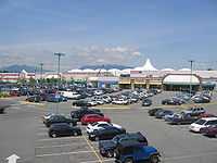
Brentwood Town Centre (most often referred to as Brentwood Mall) is a shopping mall in Burnaby, British Columbia. It is located in North Burnaby, at the intersection of Willingdon Avenue and the Lougheed Highway, approximately 1.5 kilometres from Vancouver city limits. It is also very close to the British Columbia Institute of Technology (BCIT) campus. Its characteristic white domes and peaks were designed to imitate the snow-capped North Shore Mountains in the background.
Brentwood Mall as it was known opened in 1961 as a partial open air strip centre and enclosed mall (the largest and most to-date at the time in BC) the original anchor stores were Eaton's, Loblaw's Supermarket, Zellers and around 60 other stores (some are still in the centre to this day). In the early 1970s the mall enclosed the strip centre portion and expanded, it also underwent renovations and added more stores. In the early 1980s the original Zellers store was closed and replaced with in-line mall stores (only to reopen again in the centre in late 1989). In 1988/89 the entire centre was extensively renovated and underwent a major expansion adding a full second level of stores connecting Eaton's 2nd Floor to the existing upper mall area, a food court and a brand new Zellers store on two levels (in November 1989). The supermarket anchor was also closed (Super Valu) and dismantled for the new large Zellers store. In 2000 Eaton's went into bankruptcy and the store was sold to Sears Canada (along with most of the company's assets). The same year a new London Drugs anchor opened in an expanded upper floor area. The current Sears store is one of the largest in BC on three levels and has a Sears Home Store on the entire lower level, it was completely renovated after Sears took over in early 2000. As of October 2007 Brentwood has completed renovations which commenced in 2006, in which included a newly renovated and expanded Food Court area, new flooring, new high grade washrooms, lighting and enhanced carpeted seating areas as well as a Children's play area in the Sears court. The centre is extremely busy on weekends due to its convenient location and selection of stores.
The centre will be undergoing a major redevelopment starting in 2014, details are yet to be announced however it is speculated that a new build Target store will be part of the project at a later date and not replacing the current Zellers location.
By the number of stores, it is the second largest mall in North Burnaby (after Lougheed Town Centre) and third largest in the city (after Lougheed Town Centre and Metropolis at Metrotown), with 125 stores and services. Notable retailers include Sears and London Drugs. During the Christmas season many Burnaby families bring their young children to the Mall to have their pictures taken with Santa Claus in his workshop.

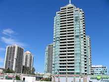
Brentwood Town Centre is also the major transit hub for North Burnaby. Public transit, serviced by TransLink, have connections to the mall, with additional routes to Vancouver, Metrotown, Simon Fraser University and the University of British Columbia. The mall is also serviced by Brentwood Town Centre Station of the SkyTrain's Millennium Line. The ongoing high-rise development boom in this part of Burnaby is linked to the strategically positioned Brentwood Mall and Brentwood Station.

Major Stores:
- London Drugs (34,249 sq. ft. / 3,181.3 m²) 1 level
- Sears (184,384 sq. ft. / 17,129.8 m²) 3 levels (former Eaton's)
- Zellers (91,823 sq. ft. / 8,530.6 m²) 2 levels - Closed March 14 2013
External links
Coordinates: 49°16′05″N 123°00′01″W / 49.268113°N 123.000205°W
| |||||||||||||||||||||||||||||