Braubach
| Braubach | ||
|---|---|---|
 | ||
| ||
 Braubach | ||
Location of Braubach within Rhein-Lahn-Kreis district  | ||
| Coordinates: 50°16′29″N 7°38′46″E / 50.27472°N 7.64611°ECoordinates: 50°16′29″N 7°38′46″E / 50.27472°N 7.64611°E | ||
| Country | Germany | |
| State | Rhineland-Palatinate | |
| District | Rhein-Lahn-Kreis | |
| Municipal assoc. | Loreley | |
| Government | ||
| • Mayor | Rita Wolf (SPD) | |
| Area | ||
| • Total | 20.26 km2 (7.82 sq mi) | |
| Elevation | 65 m (213 ft) | |
| Population (2012-12-31)[1] | ||
| • Total | 3,036 | |
| • Density | 150/km2 (390/sq mi) | |
| Time zone | CET/CEST (UTC+1/+2) | |
| Postal codes | 56338 | |
| Dialling codes | 02627 | |
| Vehicle registration | EMS | |
| Website | www.stadt-braubach.de | |


Braubach is a municipality in the Rhein-Lahn-Kreis, in Rhineland-Palatinate, Germany. It is situated on the right bank of the Rhine, approx. 10 km southeast of Koblenz. Braubach has assorted medieval architecture intact, including portions of the town wall, half-timbered buildings, and castle Marksburg on the hill above.
Braubach was the seat of the former Verbandsgemeinde ("collective municipality") Braubach.
History
In 1276 King Rudolf of Habsburg made Braubach a free city under Count Gottfried of Eppstein. Count Eberhard I of Katzenelnbogen bought the city and castle in 1283. Until 1479, the Counts rebuilt the castle constantly. The castle was never conquered and never destroyed. The City of Braubach was the administrative centre of the Katzenelnbogen wine production with Rhens, Spay, Boppard, Horchheim and Salzig and an amount of 33000 l of wine in 1438 and 84000 l of wine in 1443.[2]
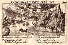
In the 1845 travel guide Le Rhin, Victor Hugo notes: "Then comes Braubach, named in a charter of 933, fief of the Counts Arnstein of Lahngau; an Imperial city under Rodolph in 1270, a domain of the Counts of Katznellenbogen in 1283; accruing to Hesse in 1473; to Darmstadt, in 1632, and in 1802 to Nassau. Braubach, communicating with the baths of the Taunus, is charmingly situated at the foot of a high rock, crested by Marksburg, the castle of which is now a state prison. No marquis but must have his page: and the Duke of Nassau has the impertinence to pretend to prisoners of state! A royal luxury! Twelve thousand six hundred habitants, in eleven hundred houses; a bridge of thirty-six boats, built in 1819, across the Rhine; a stone bridge of fourteen arches upon the Moselle, upon the very foundations raised about 1311, by the Archbishop Baldwin, by means of an ample sale of indulgences; the celebrated fort of Ehrenbreitstein, surrendered to the French the 27th January, 1799, after a blockade during which the besieged paid three francs for a cat, and thirty sous per pound for horseflesh; a well one hundred and eighty feet deep, dug by the Margrave John of Baden; the square of the arsenal, where formerly stood the famous culverine the Griffin, which carried one hundred and sixty pounds, and weighed twenty thousand; an old Franciscan convent, converted into an hospital in 1804; a Roman Nôtre Dame, restored in the Pompadour style, and painted pink; the church of St. Florin, converted into a magazine for forage by the French, and now a Protestant church, which is likewise painted pink; St. Castor, a collegiate church, embellished with a portal in 1805; and with all this no public library; such is the town which the French writers call Coblentz, out of politeness to the Germans, and the Germans Coblence, out of courtesy to the French."[3]
Partner cities
Notes and references
- ↑ "Bevölkerung der Gemeinden am 31.12.2012". Statistisches Bundesamt (in German). 2013.
- ↑ http://www.graf-von-katzenelnbogen.de/ The History of the Marksburg and the County of Katzenelnbogen and the First Riesling of the World
- ↑ Hugo, Victor (1845). Le Rhin. Wiley & Putnam. p. 274.