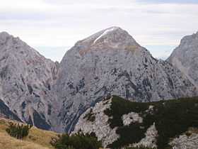
Brana (mountain)
From Wikipedia, the free encyclopedia
| Brana | |
|---|---|
 | |
| Elevation | 2,253 m (7,392 ft) |
| Location | |
 Brana | |
| Range | Kamnik–Savinja Alps |
| Coordinates | 46°21′17.89″N 14°35′15.48″E / 46.3549694°N 14.5876333°ECoordinates: 46°21′17.89″N 14°35′15.48″E / 46.3549694°N 14.5876333°E |
| Geology | |
| Age of rock | 250 million years |
| Climbing | |
| First ascent | 1875 Anton Bauer et J.Seidl |

Brana
Brana is 2.253 m high mountain in Kamnik Alps and easternmost peak of Grintovci.
Starting points
- Kamnik, Kamniška Bistrica
- Solčava, Logarska dolina
Routes
- 2½h: from Frischaufov dom na Okrešlju hut (1378 m)
- 1h: from Koča na Kamniškem sedlu hut (1864 m)
External links
This article is issued from Wikipedia. The text is available under the Creative Commons Attribution/Share Alike; additional terms may apply for the media files.