Boxmeer
From Wikipedia, the free encyclopedia
| Boxmeer | |||
|---|---|---|---|
| Municipality | |||
 | |||
| |||
 | |||
| Coordinates: 51°39′N 05°57′E / 51.650°N 5.950°ECoordinates: 51°39′N 05°57′E / 51.650°N 5.950°E | |||
| Country | Netherlands | ||
| Province | North Brabant | ||
| Area(2006) | |||
| • Total | 113.95 km2 (44.00 sq mi) | ||
| • Land | 111.56 km2 (43.07 sq mi) | ||
| • Water | 2.38 km2 (0.92 sq mi) | ||
| Population (31 May, 2009) | |||
| • Total | 28,579 | ||
| • Density | 256/km2 (660/sq mi) | ||
| Source: CBS, Statline. | |||
| Time zone | CET (UTC+1) | ||
| • Summer (DST) | CEST (UTC+2) | ||


 Boxmeer (
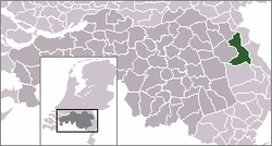
![]() pronunciation (help·info)) is a municipality and a town in the southern Netherlands. It incorporates the former municipality of Beugen en Rijkevoort and that of Vierlingsbeek. In Overloon is the Overloon War Museum.
pronunciation (help·info)) is a municipality and a town in the southern Netherlands. It incorporates the former municipality of Beugen en Rijkevoort and that of Vierlingsbeek. In Overloon is the Overloon War Museum.
Population centres
- Beugen
- Boxmeer
- Groeningen
- Holthees
- Maashees
- Oeffelt
- Overloon
- Rijkevoort
- Sambeek
- Vierlingsbeek
- Vortum-Mullem
Transport
Gallery
-

Diorama Invasion 1944, Overloon War Museum
External links
| Wikimedia Commons has media related to Boxmeer. |
 |
Cuijk | |
Maas / Gennep (LI) | |
| Sint Anthonis | |
Maas / Bergen (LI) | ||
| ||||
| | ||||
| Venray (LI) |

This article is issued from Wikipedia. The text is available under the Creative Commons Attribution/Share Alike; additional terms may apply for the media files.