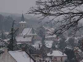
Bouvigny-Boyeffles
From Wikipedia, the free encyclopedia
| Bouvigny-Boyeffles | ||
|---|---|---|
 | ||
| ||
 Bouvigny-Boyeffles | ||
|
Location within Nord-Pas-de-Calais region  Bouvigny-Boyeffles | ||
| Coordinates: 50°25′20″N 2°40′23″E / 50.4222°N 2.6731°ECoordinates: 50°25′20″N 2°40′23″E / 50.4222°N 2.6731°E | ||
| Country | France | |
| Region | Nord-Pas-de-Calais | |
| Department | Pas-de-Calais | |
| Arrondissement | Lens | |
| Canton | Sains-en-Gohelle | |
| Intercommunality | Lens-Liévin | |
| Government | ||
| • Mayor (2008–2014) | Maurice Viseux | |
| Area | ||
| • Land1 | 9.07 km2 (3.50 sq mi) | |
| Population (2009) | ||
| • Population2 | 2,449 | |
| • Population2 Density | 270/km2 (700/sq mi) | |
| INSEE/Postal code | 62170 / 62172 | |
| Elevation |
68–192 m (223–630 ft) (avg. 116 m or 381 ft) | |
|
1 French Land Register data, which excludes lakes, ponds, glaciers > 1 km² (0.386 sq mi or 247 acres) and river estuaries. 2 Population without double counting: residents of multiple communes (e.g., students and military personnel) only counted once. | ||

Bouvigny-Boyeffles is a commune in the Pas-de-Calais department in the Nord-Pas-de-Calais region in northern France.
Geography
An ex-coalmining area, but now a farming village, situated just 8 miles (12.9 km) west of Lens at the junction of the D165 and D75 roads.
Population
| Historical population | ||
|---|---|---|
| Year | Pop. | ±% |
| 1962 | 1,869 | — |
| 1968 | 1,927 | +3.1% |
| 1975 | 2,049 | +6.3% |
| 1982 | 2,216 | +8.2% |
| 1990 | 2,317 | +4.6% |
| 1999 | 2,439 | +5.3% |
| 2005 | 2,581 | +5.8% |
| 2009 | 2,449 | −5.1% |
Sights
- The church of St. Marin, dating from the fifteenth century.
- The modern church of St. Martin.
- The eighteenth-century chateau of Boyeffles.
- The radio and TV transmitter.
See also
References
External links
| Wikimedia Commons has media related to Bouvigny-Boyeffles. |
This article is issued from Wikipedia. The text is available under the Creative Commons Attribution/Share Alike; additional terms may apply for the media files.