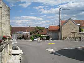
Bourberain
From Wikipedia, the free encyclopedia
| Bourberain | |
|---|---|
 | |
 Bourberain | |
|
Location within Burgundy region  Bourberain | |
| Coordinates: 47°30′04″N 5°17′49″E / 47.5011°N 5.2969°ECoordinates: 47°30′04″N 5°17′49″E / 47.5011°N 5.2969°E | |
| Country | France |
| Region | Burgundy |
| Department | Côte-d'Or |
| Arrondissement | Dijon |
| Canton | Fontaine-Française |
| Government | |
| • Mayor (2008–2014) | Robert Marichy |
| Area | |
| • Land1 | 30.71 km2 (11.86 sq mi) |
| Population (2008) | |
| • Population2 | 316 |
| • Population2 Density | 10/km2 (27/sq mi) |
| INSEE/Postal code | 21094 / 21610 |
| Elevation |
223–305 m (732–1,001 ft) (avg. 270 m or 890 ft) |
|
1 French Land Register data, which excludes lakes, ponds, glaciers > 1 km² (0.386 sq mi or 247 acres) and river estuaries. 2 Population without double counting: residents of multiple communes (e.g., students and military personnel) only counted once. | |
Bourberain is a commune in the Côte-d'Or department in eastern France.
Population
| Historical population | ||
|---|---|---|
| Year | Pop. | ±% |
| 1962 | 214 | — |
| 1968 | 251 | +17.3% |
| 1975 | 245 | −2.4% |
| 1982 | 231 | −5.7% |
| 1990 | 289 | +25.1% |
| 1999 | 278 | −3.8% |
| 2008 | 316 | +13.7% |
See also
References
| Wikimedia Commons has media related to Bourberain. |
This article is issued from Wikipedia. The text is available under the Creative Commons Attribution/Share Alike; additional terms may apply for the media files.