Bleurville
From Wikipedia, the free encyclopedia
| Bleurville | ||
|---|---|---|
 | ||
| ||
 Bleurville | ||
|
Location within Lorraine region  Bleurville | ||
| Coordinates: 48°03′41″N 5°57′50″E / 48.0614°N 5.9639°ECoordinates: 48°03′41″N 5°57′50″E / 48.0614°N 5.9639°E | ||
| Country | France | |
| Region | Lorraine | |
| Department | Vosges | |
| Arrondissement | Épinal | |
| Canton | Monthureux-sur-Saône | |
| Intercommunality | Pays de la Saône Vosgienne | |
| Government | ||
| • Mayor (2008–2014) | André Granget | |
| Area | ||
| • Land1 | 20.25 km2 (7.82 sq mi) | |
| Population (2006) | ||
| • Population2 | 372 | |
| • Population2 Density | 18/km2 (48/sq mi) | |
| INSEE/Postal code | 88061 / 88410 | |
| Elevation | 248–383 m (814–1,257 ft) | |
|
1 French Land Register data, which excludes lakes, ponds, glaciers > 1 km² (0.386 sq mi or 247 acres) and river estuaries. 2 Population without double counting: residents of multiple communes (e.g., students and military personnel) only counted once. | ||

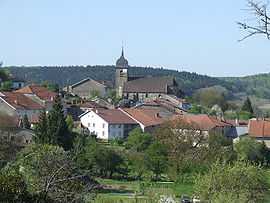
Bleurville is a commune in the Vosges department in Lorraine in northeastern France.
See also
References
This article is issued from Wikipedia. The text is available under the Creative Commons Attribution/Share Alike; additional terms may apply for the media files.