Blaufelden
From Wikipedia, the free encyclopedia
| Blaufelden | ||
|---|---|---|
| ||
 Blaufelden | ||
Location of Blaufelden within Schwäbisch Hall district 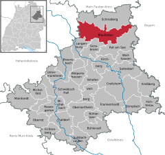
 | ||
| Coordinates: 49°17′49″N 09°58′19″E / 49.29694°N 9.97194°ECoordinates: 49°17′49″N 09°58′19″E / 49.29694°N 9.97194°E | ||
| Country | Germany | |
| State | Baden-Württemberg | |
| Admin. region | Stuttgart | |
| District | Schwäbisch Hall | |
| Government | ||
| • Mayor | Klaus Köger (Ind.) | |
| Area | ||
| • Total | 90.18 km2 (34.82 sq mi) | |
| Elevation | 460 m (1,510 ft) | |
| Population (2012-12-31)[1] | ||
| • Total | 5,148 | |
| • Density | 57/km2 (150/sq mi) | |
| Time zone | CET/CEST (UTC+1/+2) | |
| Postal codes | 74572 | |
| Dialling codes | 07953 | |
| Vehicle registration | SHA | |
| Website | www.blaufelden.de | |

Blaufelden is a municipality in the district of Schwäbisch Hall in Baden-Württemberg in Germany.
References
- ↑ [Statistisches Bundesamt – Gemeinden in Deutschland mit Bevölkerung am 31.12.2012 (XLS-Datei; 4,0 MB) (Einwohnerzahlen auf Grundlage des Zensus 2011) "Gemeinden in Deutschland mit Bevölkerung am 31.12.2012"]. Statistisches Bundesamt (in German). 12 November 2013.
This article is issued from Wikipedia. The text is available under the Creative Commons Attribution/Share Alike; additional terms may apply for the media files.