Black Rock Range
| Black Rock Range | |
|---|---|
 Black Rock Point and the Black Rock Range | |
| Highest point | |
| Peak | Pahute Peak/Big Mountain |
| Elevation | 8,566 ft (2,611 m) |
| Geography | |
<div style="padding:2px 2px 5px 2px;> | |
| Country | United States |
| State | Nevada |
| Region | Black Rock Desert |
| District | Humboldt County |
| Range coordinates | 41°16′48″N 119°03′38″W / 41.2799°N 119.0605°WCoordinates: 41°16′48″N 119°03′38″W / 41.2799°N 119.0605°W |

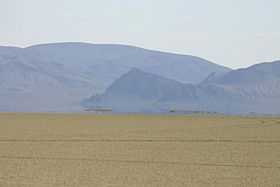
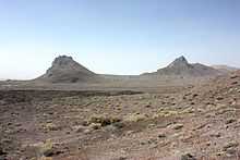
The Black Rock Range is a mountain range in northwestern Nevada.[1] It is named for Black Rock Point, which is located at the southern end of the range. The Black Rock Range divides the Black Rock Desert into eastern and western arms. Pahute Peak, also known as Big Mountain,[2] is the highest point in the range at 8,566 feet (2,611 m) above sea level.
The majority of the range is part of the Black Rock Desert-High Rock Canyon Emigrant Trails National Conservation Area. In addition two separate federally designated wilderness areas are part of the Black Rock Range. Those wilderness areas are Pahute Peak Wilderness and the North Black Rock Range Wilderness.
In December 2009, the Bureau of Land Management announced a roundup of 2500 wild horses out of an estimated population of 3000 in the Black Rock Range and vicinity, due to overpopulation.[3]
References
- ↑ "Black Rock Range". Geographic Names Information System, U.S. Geological Survey. Retrieved 2008-01-11.
- ↑ "Big Mountain". Geographic Names Information System, U.S. Geological Survey. Retrieved 2008-01-13.
- ↑ Linthicum, Kate (2009-12-29). "Controversial roundup of wild horses underway". Los Angeles Times. Retrieved 2010-02-22.
External links
- "Black Rock Range". Peakbagger.com.
- Washoe County Trail Guide: Black Rock Point at Reno Gazette-Journal
- 41N-119W Confluence Point - 41 degrees north latitude and 119 degrees west longitude, located at the base of the Black Rock Range
