Biysk
| Biysk (English) Бийск (Russian) | |
|---|---|
| - City[1] - | |
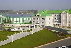
 Sovetskaya Street in Biysk | |
.svg.png) Location of Altai Krai in Russia | |
 Biysk | |
|
| |
_(1804).png) Coat of arms | |
| City Day | June 18[citation needed] |
| Administrative status (as of December 2011) | |
| Country | Russia |
| Federal subject | Altai Krai[1] |
| Administratively subordinated to | city of krai significance of Biysk[1] |
| Administrative center of | city of krai significance of Biysk,[1] Biysky District[1] |
| Municipal status (as of March 2009) | |
| Urban okrug | Biysk Urban Okrug[2] |
| Administrative center of | Biysk Urban Okrug,[2] Biysky Municipal District[3] |
| Head[citation needed] | Lidiya Gromoglasova[citation needed] |
| Representative body | Duma[citation needed] |
| Statistics | |
| Area | 291.67 km2 (112.61 sq mi)[citation needed] |
| Population (2010 Census) | 210,115 inhabitants[4] |
| - Rank in 2010 | 89th |
| Density | 720 /km2 (1,900 /sq mi)[5] |
| Time zone | OMST (UTC+07:00)[6] |
| Founded | 1709[7] |
| City status since | 1782[7] |
| Postal code(s)[8] | 659300 |
| Dialing code(s) | +7 3854[citation needed] |
|
| |
|
| |
Biysk (Russian: Бийск, IPA: [bʲijsk]) is a city in Altai Krai, Russia, located on the Biya River not far from its confluence with the Katun River. It is the second largest city of the krai (after Barnaul). Population: 210,115 (2010 Census);[4] 218,562 (2002 Census);[9] 233,238 (1989 Census).[10]
Geography
The city is called "the gates to the Altai Mountains", because of its position comparatively not far from this range. Chuysky Highway begins in Biysk and then goes through the Altai Republic to Russia's border with Mongolia.
History
The fortress of Bikatunskaya (Бикатунская), or Bikatunsky Ostrog (Бикатунский острог), was founded in 1708-1709:[7] it was constructed near the confluence of Biya and Katun Rivers (hence the name) in 1709 by the order the Russian Tsar Peter the Great signed in 1708.[11] Yet, in 1710, after a three-day battle, the ostrog was destroyed by the Dzungar people.[11] The Bikatunskaya fortress was re-built at a new place (20 kilometers (12 mi) up the Biya, on the right bank of the river) in 1718 and renamed Biyskaya (Бийская) in 1732.[11] Gradually, Biysk lost its role as a military base, but became an important center of trade, and was granted town status in 1782.[7] In 1797, the town was abolished, but in 1804 it was restored as an uyezd town of Tomsk Governorate and granted the coat of arms which is still in use.
Administrative and municipal status
Within the framework of administrative divisions, Biysk serves as the administrative center of Biysky District, even though it is not a part of it.[1] As an administrative division, it is, together with four rural localities, incorporated separately as the city of krai significance of Biysk—an administrative unit with the status equal to that of the districts.[1] As a municipal division, the city of krai significance of Biysk is incorporated as Biysk Urban Okrug.[2]
Economy
The city's industry grew rapidly, especially after some factories were evacuated there from the west of the Soviet Union during the World War II. Later the city was an important center of arms development and production and still remains an industrial center.
Evalar, one of the largest pharmaceutical companies in Russia, is headquartered in Biysk.
Transportation
Biysk has a railway station, a port on the Biya, and is served by the Biysk Airport. The route of federal importance Novosibirsk-Biysk-Tashanta (Chuysky Highway) passes through the city.
Education and culture
Biysk is a center of education and culture, and a home to an academy of education, a technical institute and other educational institutions, a drama theater (founded in 1943), a museum of local lore, and other facilities.
References
Notes
- ↑ 1.0 1.1 1.2 1.3 1.4 1.5 1.6 Law #28-ZS
- ↑ 2.0 2.1 2.2 Law #115-ZS
- ↑ Law #42-ZS
- ↑ 4.0 4.1 "Всероссийская перепись населения 2010 года. Том 1" [2010 All-Russian Population Census, vol. 1]. Всероссийская перепись населения 2010 года (2010 All-Russia Population Census) (in Russian). Federal State Statistics Service. 2011. Retrieved June 29, 2012.
- ↑ The value of density was calculated automatically by dividing the 2010 Census population by the area specified in the infobox. Please note that this value may not be accurate as the area specified in the infobox does not necessarily correspond to the area of the entity proper or is reported for the same year as the population.
- ↑ Правительство Российской Федерации. Постановление №725 от 31 августа 2011 г. «О составе территорий, образующих каждую часовую зону, и порядке исчисления времени в часовых зонах, а также о признании утратившими силу отдельных Постановлений Правительства Российской Федерации». Вступил в силу по истечении 7 дней после дня официального опубликования. Опубликован: "Российская Газета", №197, 6 сентября 2011 г. (Government of the Russian Federation. Resolution #725 of August 31, 2011 On the Composition of the Territories Included into Each Time Zone and on the Procedures of Timekeeping in the Time Zones, as Well as on Abrogation of Several Resolutions of the Government of the Russian Federation. Effective as of after 7 days following the day of the official publication.).
- ↑ 7.0 7.1 7.2 7.3 Большая российская энциклопедия. Том 3. Moscow: Большая российская энциклопедия. 2005. p. 473. ISBN 978-5-85270-330-9.
- ↑ Почта России. Информационно-вычислительный центр ОАСУ РПО. Поиск объектов почтовой связи (Russian)
- ↑ "Численность населения России, субъектов Российской Федерации в составе федеральных округов, районов, городских поселений, сельских населённых пунктов – районных центров и сельских населённых пунктов с населением 3 тысячи и более человек" [Population of Russia, its federal districts, federal subjects, districts, urban localities, rural localities—administrative centers, and rural localities with population of over 3,000]. Всероссийская перепись населения 2002 года (All-Russia Population Census of 2002) (in Russian). Federal State Statistics Service. May 21, 2004. Retrieved February 9, 2012.
- ↑ Demoscope Weekly (1989). "Всесоюзная перепись населения 1989 г. Численность наличного населения союзных и автономных республик, автономных областей и округов, краёв, областей, районов, городских поселений и сёл-райцентров." [All Union Population Census of 1989. Present population of union and autonomous republics, autonomous oblasts and okrugs, krais, oblasts, districts, urban settlements, and villages serving as district administrative centers]. Всесоюзная перепись населения 1989 года (All-Union Population Census of 1989) (in Russian). Institute of Demographics of the State University—Higher School of Economics. Retrieved February 9, 2012.
- ↑ 11.0 11.1 11.2 Основание Бийской крепости
Sources
- Алтайский краевой Совет народных депутатов. Закон №28-ЗС от 1 марта 2008 г. «Об административно-территориальном устройстве Алтайского края», в ред. Закона №73-ЗС от 12 ноября 2013 г. «О внесении изменений в Закон Алтайского края "Об административно-территориальном устройстве Алтайского края"». Вступил в силу 8 марта 2008 г. Опубликован: "Алтайская правда", №67, 8 марта 2008 г. (Altai Krai Council of People's Deputies. Law #28-ZS of March 1, 2008 On the Administrative-Territorial Structure of Altai Krai, as amended by the Law #73-ZS of November 12, 2013 On Amending the Law of Altai Krai "On the Administrative-Territorial Structure of Altai Krai". Effective as of March 8, 2008.).
- Алтайский краевой Совет народных депутатов. Закон №115-ЗС от 7 ноября 2006 г. «О статусе и границах муниципального и административно-территориального образования город Бийск Алтайского края», в ред. Закона №16-ЗС от 10 марта 2009 г «О внесении изменений в отдельные Законы Алтайского края о статусе и границах муниципальных и административно-территориальных образований Алтайского края». Вступил в силу через 10 дней после дня официального опубликования. Опубликован: "Алтайская правда", №362–363, 16 ноября 2006 г. (Altai Krai Council of People's Deputies. Law #115-ZS of November 7, 2006 On the Status and the Borders of the Municipal and the Administrative-Territorial Formation of the City of Biysk of Altai Krai, as amended by the Law #16-ZS of March 10, 2009 On Amending Several Laws of Altai Krai on the Status and the Borders of the Municipal and the Administrative-Territorial Formations of Altai Krai. Effective as of the day which is 10 days after the day of the official publication.).
- Алтайский краевой Совет народных депутатов. Закон №42-ЗС от 8 мая 2007 г. «О статусе и границах муниципальных и административно-территориальных образований Бийского района Алтайского края», в ред. Закона №16-ЗС от 10 марта 2009 г «О внесении изменений в отдельные Законы Алтайского края о статусе и границах муниципальных и административно-территориальных образований Алтайского края». Вступил в силу через 10 дней после дня официального опубликования. Опубликован: "Алтайская правда", №150 (без приложений), 24 мая 2007 г. (Altai Krai Council of People's Deputies. Law #42-ZS of May 8, 2007 On the Status and the Borders of the Municipal and the Administrative-Territorial Formations of Biysky District of Altai Krai, as amended by the Law #16-ZS of March 10, 2009 On Amending Various Laws of Altai Krai on the Status and the Borders of Municipal and Administrative-Territorial Formations of Altai Krai. Effective as of after 10 days from after the day of the official publication.).