Biharinath
| Biharinath | |
|---|---|
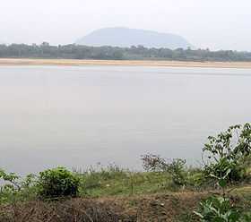 Biharinath from Nehru Park, Burnpur across the Damodar River | |
| Elevation | 451 m (1,480 ft) |
| Location | |
| Location | Saltora, Bankura district, West Bengal, India |
| Range | Chota Nagpur Plateau |
Biharinath (Bengali: বিহারীনাথ) is the tallest hill of Bankura District, in the Indian state of West Bengal., and one of the dense forest areas of the district. It is 451 metres (1,480 ft) high.[1] It is situated about 60 kilometres (37 mi) north-west of Bankura town and 14 kilometres (9 mi) north-east of Saltora town.
Archaeological importance
With the discovery of Paleolithic tools in the Biharinath area, the hill and the surrounding areas have come into focus of archaeologists.[2]
Tourism
The base of Biharinath is a popular tourist spot. A small tank measuring 0.50 ha provides facilities for angling. There is an old Jain temple of Biharinath nearby.[3]
Biharinath offers a pollution free green surroundings where water is panacea. This place has hills, dense forests with abundant flora and fauna, spring, water bodies, Damodar River, and a renowned Shiva temple. Susunia hill, Joychandi Pahar, Garh Panchkot, Baranti, Panchet Dam, and Maithon Dam are all located at short distances.
Economy
The area also has coal deposits. Biharinath block represents south central part of Raniganj Coalfield in Trans Damodar region. The entire area is covered with alluvial soil.[4] People here are mostly dependent on coal mines or visit Asansol/Durgapur area to find a job.After tourism is flourishing at Biharinath people here is getting tourism related job gradually.
References
- ↑ "Biharinath". West Bengal. india9.com. Retrieved 2008-03-17.
- ↑ "Status of Prehistoric studies in the twenty first century in India". C01-13 Progress of Prehistory in Bengal: a cultural overview. UISPP / IUPPS │ XV Congress. Retrieved 2008-03-13.
- ↑ "Biharinath". District administration. Retrieved 2008-03-19.
- ↑ "Salient Features". Coal ministry. Retrieved 2008-03-19.
| Wikivoyage has a travel guide for Biharinath. |
| |||||||||||||||||||||||||||||||||||||||||||||||||||||||
| |||||||||||