Bicol Region
| Bicol Region Region V | |
|---|---|
| Region | |
| Nickname(s): Kabikolan; Bicolandia | |
 | |
| Country | Philippines |
| Island group | Luzon |
| Regional center | Legazpi City |
| Area | |
| • Total | 18,054.3 km2 (6,970.8 sq mi) |
| Population (2010)[1] | |
| • Total | 5,420,411 |
| • Density | 300/km2 (780/sq mi) |
| Time zone | PST (UTC+8) |
| Provinces | 6 |
| Cities | 7 |
| Municipalities | 107 |
| Barangays | 3,471 |
| Cong. districts | 14 |
| Languages | Bikol, Albayano, Masbateño, Rinconada, Pandan Bikol, Sorsoganon, Tagalog |
| Website | Bicol Region Official Website |
Coordinates: 13°30′N 123°20′E / 13.500°N 123.333°E The Bicol Region (Filipino: Kabikulan; Spanish: Bicolandia) is one of the 17 Regions of the Philippines, designated as Region V. Bicol (also spelled Bikol) is composed of four provinces in the Bicol Peninsula, the southeastern end of Luzon island, and two island-provinces adjacent to the peninsula.[2] The regional centre is considered to be in Legazpi City, Albay.[3][4]
Geography
The Bicol Region is located in the southernmost tip of Luzon Island, the largest island in the Philippine archipelago. The total land area of the region is 18,054.3 km2 (6,970.8 sq mi),[5] which or 5.9% of the total land area of the country. Around 69.3% of the total land area is alienable and disposable while the remaining 30.7% is public forest areas.[2]
The region is bounded by Lamon Bay to the north, Pacific Ocean to the east, and Sibuyan Sea and Ragay Gulf to the west. The northernmost province, Camarines Norte, is bordered to the north by the province of Quezon, thereby connecting the region to the rest of Luzon.
History
Albay's archaeology shows concrete evidence of trade with China, Malaya and Indonesia going back two thousand years. The first Spanish contact was in 1565, when a treasure-galleon returning to Cebu from Acapulco, Mexico, was swept off course and the captain recorded his awe at the sight of Mt. Mayon erupting.[citation needed]
Demographics
| Population census of Bicol | ||
|---|---|---|
| Year | Pop. | ±% |
| 1990 | 3,910,001 | — |
| 2000 | 4,686,669 | +19.9% |
| 2010 | 5,420,411 | +15.7% |
| Source: National Statistics Office[6] | ||
Language
The people of the Bicol region, called Bicolanos, speak any of the several languages of the Bikol sociolinguistic language, also called Bikolano, an Austronesian language closely related to other Central Philippine languages such as Cebuano and Tagalog. Bicol languages include the Inland Bikol of Bikol-Rinconada (Rinconada area), Bikol-Cam. Sur (Buhi, Cam. Sur; Libon, Oas, Daraga, Albay and Donsol, Sorsogon), Bikol-Pandan (Northern Catanduanes). Standard Bikol is based from the coastal Bikol language of the dialect of Legazpi City and is understood widely throughout the region even though they cannot speak it fluently.
Bikol is the dominant language of the region. The Filipino language (Tagalog) is also spoken in northern parts of Camarines Norte as well as in the municipality of Del Gallego, Camarines Sur. Two Visayan languages, Sorsoganon and Masbateño or Minasbate, are spoken in Masbate and Sorsogon; they are collectively referred to as Bisakol.

Religion
The region retains Roman Catholicism as the overwhelming religion of the great majority. The Catholic religion has the highest number of followers than any other area in the Philippines.
Fiestas (Feast day of saints) are annual celebrations of parishes, from a simple barrio fiesta honoring a patron associated for good harvest, to a town fiesta honoring a miraculous saint, a diocesan fiesta like the feast of Our Lady of Salvation, or a regional one such as the Our Lady of Peñafrancia Fiesta, a week-long celebration to honor the Virgin Mary, dubbed as the "Patroness of Bicolandia". It is widely acknowledged that in Luzon, it is Bicol Region that holds the most number of men entering the seminary for Catholic priesthood, or women entering the religious life to become Catholic nuns. [citation needed]
Political division

The region is composed of six provinces: Albay, Camarines Norte, Camarines Sur, Sorsogon and the island-provinces of Catanduanes and Masbate. It has one independent component city, Naga City, and six component cities — Iriga, Legazpi, Ligao, Masbate City, Sorsogon City, and Tabaco City. Masbate City and Sorsogon City are cities in their namesake provinces.
As of 2010, Camarines Sur is the largest province in area and population, occupying 5,481.6 km2 (2,116.5 sq mi) or around 30.4% of the total land area with a population of 1,822,371. Catanduanes is the smallest in area as well as population with only 1,511.5 km2 (583.6 sq mi) or 8.4% of the total regional area and a population of 246,300.[1]
The political and administrative center of the region is Legazpi City.[2] while the religious center is Naga City — which is also colloquially known as the Queen City of Bicol.
| Provinces | Capital | No. of Cities |
No. of Municipalities |
No. of Barangays |
Income classification (2007)[7] |
Area (km²) |
Population (2010)[1] |
ZIP Code | Governor | ||
|---|---|---|---|---|---|---|---|---|---|---|---|
| Albay | |||||||||||
| Camarines Norte | |||||||||||
| Camarines Sur | |||||||||||
| Catanduanes | |||||||||||
| Masbate | |||||||||||
| Sorsogon | |||||||||||
Geology
Bicol region is volcanic in origin and part of the Pacific Ring of Fire. Known as the Bicol Volcanic Arc or Chain, the volcanoes are the results of the Philippine Sea Plate subducting under the Philippine Mobile Belt, along the Philippine Trench. Volcanism is evident by the number of hot springs, crater lakes, and volcanoes that dot the region starting from Mount Labo in Camarines Norte to the Gate Mountains in Matnog, Sorsogon.[14] Mayon Volcano is the most prominent of the volcanoes in the region, famous for its almost perfect conical shape and for being the most active in the Philippines. Its eruptions have repeatedly inflicted disasters on the region, but during lulls in activity, it is a particularly beautiful mountain. The southernmost tip of the peninsula is dominated by Bulusan Volcano, the other active volcano in the region. Tiwi in Albay and the Bacon-Manito area between Sorsogon and Albay are the sites of two major geothermal fields that contribute substantially to the Luzon Power Grid.[15][16]
Volcanoes of the Bicol Region
From North to South
| Photo | Name |
|---|---|
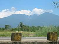 |
Mount Isarog is a 1,966-metre (6,450 ft) fumarolic volcano with a 2.5-kilometre (1.6 mi) wide crater breached to the east.[17] The mountain and vicinity covering 10,112 hectares (24,990 acres) is a protected area in the Bicol Region under the name Mount Isarog Natural Park.[18] |
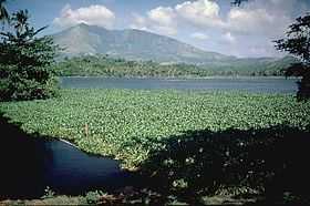 |
Mount Iriga is a 1,196-metre (3,924 ft) volcano with a large horseshoe-shaped collapsed crater located adjacent to Lake Buhi (foreground).[19] |
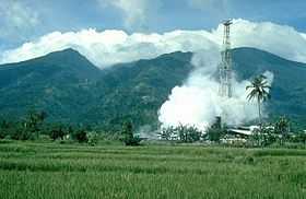 |
Mount Malinao is a 1,548-metre (5,079 ft) volcano with a large crater about 3 kilometres (1.9 mi) at its widest, which is breached to the east, The geothermal fields of Tiwi are located on its lower eastern slope.[20] |
 |
Mount Masaraga is a sharp-topped 1,328-metre (4,357 ft) Holocene volcano NW of Mayon.[21] |
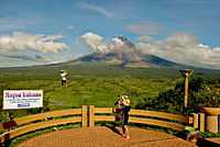 |
Mayon Volcano, the highest at 2,463 metres (8,081 ft), is also the most popular in the region for its beautifully symmetrical cone. It is also the most active in the country.[22] The volcano is one of the protected areas of Region V under the name Mayon Volcano Natural Park encompassing 5,776 hectares (14,270 acres).[18] |
 |
Pocdol Mountains with its highest elevation at 1,102 metres (3,615 ft), is a fumarolic group of volcanoes situated between Albay and Sorsogon provinces. It is the location of the Bac-Man Geothermal Power Plant and the PNOC Eco-Park, a 25,100-hectare (62,000-acre) ecotourism park maintained and protected by the Philippine National Oil Company (PNOC).[23][24] |
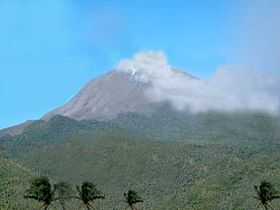 |
Bulusan Volcano, the other active volcano of the region, has an altitude of 1,565 metres (5,135 ft). It is located on the remains of the 11-kilometre (6.8 mi) Irosin Caldera.[25] The volcano is a protected area and the centerpiece of the 3,672-hectare (9,070-acre) Bulusan Volcano Natural Park.[18] |
Economy
Bicol Region has a large amount of rich flat land, and agriculture is the largest component of the economy with close to 50% depending their livelihood on the industry. Coconuts, abaca, banana, coffee and jackfruit are the top five permanent crops in the region. Rice and maize are among the chief seasonal crops of the region. Commercial fishing is also important with thirteen major fishing grounds supplying fish markets in places as far as Metro Manila. Agriculture and fishing are the major factors in the province's economy.[2][26]
Mining is also one of the contributors to the region's economy. Several handicrafts, jewelry manufacturing, other small-scale industries and manufacturing enterprises that is located in Camarines Norte bolster rural and regional incomes.
Legazpi City boasts its tourism and businesses as the city helps improve the economy. The city also gives a large percentage, 20.5% in the over-all economy of Bicol. The city is the location of the Legazpi City International Seaport which generously gives the largest percentage in the city's economy also the entire region.The city is also the Educational Center of Bicol after the Bicol University Belt had been organized here.
Sorsogon City and Sorsogon has greatly contributed to the eco-tourism of the region. The areas known to have been most popular in the place which offer beaches are the Subic Beach in Matnog, Dancalan Beach in Bulusan and the Paguriran Island in Sorsogon City. Also, in Donsol, Sorsogon, it has been a center for the Butanding or Whale Shark exposure tours. The province also produces mass numbers of Pili, a native fruit to have brought many functions.
Tourism
_(794278440).jpg)
The region has recently seen a revival in its tourism industry, due to the popularity of Mayon Volcano, the new CamSur Water Sports Complex, whale shark spotting, among others, which consequently increased the number of upscale resorts.
Owing to its location, Region V offers plenty of choices for visitors — beautiful natural features like beaches, mountains and waterfalls with lush vegetation. Activities include scuba diving to wrecked galleons, spelunking, and mountaineering or visits to man-made attractions like church architecture from the Spanish Colonial period, etc.
The municipality of Daet and Catanduanes province have long been destinations for surfers.[27] The opening of the Southern Luzon International Airport in Legazpi City, which is under construction, is hoped to further boost tourism in the region.
Media
The Bicol Region is the main media hub for both the region and the island of Mindanao. It is the home to many media outlets for both the million-nighttime and the 4-million daytime population of the city. Large media networks such as ABS-CBN Broadcasting Network, GMA Network, Inc., TV5, National Broadcasting Network, and RPN9 maintain their respective local stations and branches for viewership, commercial and news coverage purposes. Most of these stations broadcast local news and public affairs as well as entertainment and dramas to cater the local viewers.
Cable television operators are putting up cable TV stations in an effort to spread the TV signals all over the region. They also offer free worldwide array of television stations for various channels for news, sports, drama, cartoons, and advertisements.
Television networks
- ABS-CBN: Channel 11 (Naga), Channel 4 (Legazpi), Channel 23 (Daet) and Channel 7 (Sorsogon) and (Virac)
- Studio 23: Channel 23
- ETC: Channel 9
- TV5: Channel 5
- AksyonTV: Channel 41
- GMA Network: Channel 7
- GMA News TV: Channel 11
- Cartoon Network: Channel 43
News Programs
- TV Patrol Bicol - ABS-CBN (Channel 11 Naga, Channel 4 Legazpi, Channel 23 Daet and Channel 7 Sorsogon and Virac)
- Baretang Bikol - (GMA TV-7 Naga)
Newspaper
Also, Miss Universe 4th runner up, Maria Venus Bayanito Raj lives in bicol reigion.Raj placed 3rd and 4th in the swimsuit and evening gown respectively.
References
- ↑ 1.0 1.1 1.2 "2010 Census of Population and Housing - Region 5". National Statistics Office, Philippines. Retrieved on 2012-05-11.
- ↑ 2.0 2.1 2.2 2.3 "Overview of Bicol Region". Department of Agriculture Web Site. Retrieved on 2012-05-22.
- ↑ "DILG Regional Office No. 5 Directory". Bicol Region Official Website - DILG. Retrieved on 2012-05-22.
- ↑ http://bicol.da.gov.ph/Statistics/regional_profile.html
- ↑ The total land area is derived from the summation of provincial areas from the table below
- ↑ "Population and Annual Growth Rates for The Philippines and Its Regions, Provinces, and Highly Urbanized Cities". 2010 Census and Housing Population. National Statistics Office. Retrieved 9 August 2013.
- ↑ "Bicol Region". Philippine Standard Geographic Code. Retrieved on 2012-05-11.
- ↑ "Basic Facts and Figures - Albay". Department of Interior and Local Government (Philippines)/ Retrieved on 2012-05-11.
- ↑ "Basic Facts and Figures - Camarines Norte". Department of Interior and Local Government (Philippines)/ Retrieved on 2012-05-11.
- ↑ "Basic Facts and Figures - Camarines Sur". Department of Interior and Local Government (Philippines)/ Retrieved on 2012-05-11.
- ↑ "Basic Facts and Figures - Catanduanes". Department of Interior and Local Government (Philippines)/ Retrieved on 2012-05-11.
- ↑ "Basic Facts and Figures - Masbate". Department of Interior and Local Government (Philippines)/ Retrieved on 2012-05-11.
- ↑ "Basic Facts and Figures - Sorsogon". Department of Interior and Local Government (Philippines)/ Retrieved on 2012-05-11.
- ↑ McDermott, Delfin, Defant, et al (2005). "The Petrogenesis of Volcanics from Mt Bulusan and Mt. Mayon in the Bicol Arc, Philippines". University College Dublin School of Geologic Sciences. Retrieved on 2012-05-22.
- ↑ "Our Geothermal Projects". Energy Development Corporation. Retrieved on 2011-08-01.
- ↑ (2009-01-20). "The Tiwi Geothermal Plant". JCMiras.net Gallery. Retrieved on 2011-08-01.
- ↑ "Isarog". Global Volcanism Program, Smithsonian Institution. http://www.volcano.si.edu/world/volcano.cfm?vnum=0703-042. Retrieved 2012-05-22.
- ↑ 18.0 18.1 18.2 "Protected areas of Region 5". Bureau of Protected Areas and Wildlife Bureau. Retrieved on 2012-05-22.
- ↑ "Iriga". Global Volcanism Program, Smithsonian Institution. http://www.volcano.si.edu/world/volcano.cfm?vnum=0703-041. Retrieved 2012-05-22.
- ↑ "Malinao". Global Volcanism Program, Smithsonian Institution. http://www.volcano.si.edu/world/volcano.cfm?vnum=070304%3DA. Retrieved 2012-05-22.
- ↑ "Masaraga". Global Volcanism Program, Smithsonian Institution. http://www.volcano.si.edu/world/volcano.cfm?vnum=0703-031. Retrieved 2012-05-22.
- ↑ "Mayon". Global Volcanism Program, Smithsonian Institution. http://www.volcano.si.edu/world/volcano.cfm?vnum=0703-03%3D. Retrieved 2012-05-22.
- ↑ "Pocdol Mountains". Global Volcanism Program, Smithsonian Institution. http://www.volcano.si.edu/world/volcano.cfm?vnum=0703-02%3D. Retrieved 2012-05-22.
- ↑ Jamoralin, Reynaldo T.. "Places of Interest". Sorsogon Tourism. Retrieved on 2012-05-22.
- ↑ "Bulusan". Global Volcanism Program, Smithsonian Institution. http://www.volcano.si.edu/world/volcano.cfm?vnum=0703-01%3D. Retrieved 2012-05-22.
- ↑ "Top 5 Permanent Crops, Region V". Department of Agriculture, Region V. Retrieved on 2011-08-01.
- ↑ "Catanduanes surfing". Philippines Travel Guide. Retrieved on 2011-08-01.
External links
| Wikimedia Commons has media related to Bicol Region. |
- Bicol Region Official Website, Department of Interior and Local Government
- Department of Tourism at Wow Bicol
- Bicolano Radio Stations Online
- List of Bicol Region Festivals & Fiestas
- List of Places to stay and visit in Bicol
| |||||||||||
| |||||||||||||||||||||||||||

