Bhatlapenumarru
| Bhatlapenumarru భట్లపెనుమర్రు | |
|---|---|
| Village | |
 Bhatlapenumarru | |
| Coordinates: 16°17′07″N 80°54′27″E / 16.285396°N 80.907471°ECoordinates: 16°17′07″N 80°54′27″E / 16.285396°N 80.907471°E | |
| Country |
|
| State | Andhra Pradesh |
| District | Krishna |
| Languages | |
| • Official | Telugu |
| Time zone | IST (UTC+5:30) |
| PIN | 521138 |
| Nearest city | Vijayawada |
Bhatlapenumarru (Telugu: భట్లపెనుమర్రు ) is a village in Krishna District in Andhra Pradesh, India. It is located approximately 40 km from Vijayawada City, 35 km from Machilipatnam (District Headquarters) and 10 km from Movva (Mandal Headquarters).
History
Bhatlapenumarru was previously an agraharam donated to the bhatraju community by Gajapathi Kings so is the name Bhatla (Telugu dialect of plural version of the word Bhat) and penumarru (Meaning large locality).
Famous People

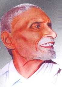
Indian freedom fighter and the designer of the Indian National Flag Sri Pingali Venkayya (Telugu: పింగళి వెంకయ్య)(2 August 1878 – 4 July 1963) was born in this village.[1][2] In honor and remembrance of the man who designed the Indian National Flag, a statue was erected in the center of the village opposite the library.[3]
Arjuna Award winner Sri Kamineni Eswara Rao was born in this village.[4][5] He was adjudged "Strongest Man of India" in 1954 Senior Nationals and was remarked by American coach Bob Hoffman as "Powerhouse".[6] He represented India as weightlifter in 1956 Melbourne Olympics, 1960 Rome Olympics[7] and the first Asian Games(1951).In 2009, a Gymnasium "Sri Kamineni" was established in honor of Sri Kamineni Eswara Rao at Pedapudi, Kuchipudi Center.[8]
Transportation
Vijayawada Jn is the nearest railway station. Bhatlapenumarru is well connected by roads. It can be reached from Vijayawada via Bandar/MG Road Road or Chintala Road. It is approximately 8 km from NH9.
Geography
Bhatlapenumarru is located at 16°27′00″N 80°47′00″E / 16.4500°N 80.7833°E.[9] It is at an altitude of approximately 5m (19feet).[10]
References
- ↑ The Hindu Newspaper Article Dated Feb 04, 2008
- ↑ The Hindu Newspaper Article Dated Aug 16 ,2011
- ↑ The Hindu Newspaper article dated Feb 01,2008
- ↑ OneIndia News
- ↑ They keep the city flag flying high - The Hindu Newspaper article
- ↑ The Hindu Newspaper article dated Aug 12,2004
- ↑ OneIndia News
- ↑ Local(Pedasanagallu, Near Kuchipudi) Newsblog
- ↑ Google Maps Result for Bhatlapenumarru
- ↑ Approximated to Pamarru Data