Berzo San Fermo
From Wikipedia, the free encyclopedia
| Berzo San Fermo | ||
|---|---|---|
| Comune | ||
| Comune di Berzo San Fermo | ||
 | ||
| ||
 Berzo San Fermo | ||
| Coordinates: 45°43′N 09°54′E / 45.717°N 9.900°ECoordinates: 45°43′N 09°54′E / 45.717°N 9.900°E | ||
| Country | Italy | |
| Region | Lombardy | |
| Province | Bergamo (BG) | |
| Government | ||
| • Mayor | Edoardo Cambianica (since June 14, 2004) | |
| Area | ||
| • Total | 5 km2 (2 sq mi) | |
| Elevation | 350 m (1,150 ft) | |
| Population (2001) | ||
| • Total | 1,142 | |
| • Density | 230/km2 (590/sq mi) | |
| Demonym | Berzesi | |
| Time zone | CET (UTC+1) | |
| • Summer (DST) | CEST (UTC+2) | |
| Postal code | 24060 | |
| Dialing code | 035 | |
Berzo San Fermo is a comune in the province of Bergamo, in Lombardy.
Bounding comuni
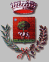
Coat of arms
The coat of arms are made up with a red-brick shield representing the wall over the green grass with a tree in the middle and a cow in the middle. The stems include a laurel on the left and a piney one on the right.
External links
- Map and aerial photos
This article is issued from Wikipedia. The text is available under the Creative Commons Attribution/Share Alike; additional terms may apply for the media files.