Beinn Chabhair
From Wikipedia, the free encyclopedia
| Beinn Chabhair | |
|---|---|
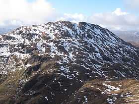
 Beinn Chabhair viewed from below Beinn a' Chroin | |
| Elevation | 933 m (3,061 ft)[1] |
| Prominence | 314 m (1,030 ft)[2] |
| Parent peak | An Caisteal |
| Listing | Munro |
| Translation | Hill of the Hawk [3] (Gaelic) |
| Pronunciation |
Gaelic [ˈpeiɲ ə ˈxavəɾʲ] ( |
| Location | |
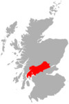
| Location | Stirling, Scotland |
| OS grid | NN36751793 |
| Coordinates | 56° 20' N; 4° 38' W |
| Topo map | OS Landranger 50 |
| Climbing | |
| Easiest route | Hillwalking |
Beinn Chabhair (Gaelic: Beinn a' Chabhair) is a Scottish mountain. It has fine views down to Loch Lomond.
A common approach is from Inverarnan, up a steep eroded path beside the dramatic waterfalls of the Ben Glas Burn then finding a vague route across fairly level but very boggy moorland before walking up the hill itself and finding a way around a series of craggy outcrops to the summit.[4]
References
| Wikimedia Commons has media related to Beinn Chabhair. |
- ↑ "walkhighlands Beinn Chabhair". walkhighlands.co.uk. 2013. Retrieved 15 October 2013.
- ↑ "Beinn Chabhair, Scotland". Peakbagger.com.
- ↑ Beinn Chabhair (Munro) - MunroMagic.com
- ↑ "Beinn Chabhair, from Inverarnan (Walkhighlands)". Retrieved 3 October 2011.
- The Munros, Scottish Mountaineering Trust, 1986, Donald Bennett (Editor) ISBN 0-907521-13-4
| ||||||||||||||
Coordinates: 56°19′32″N 4°38′30″W / 56.32554°N 4.64164°W
This article is issued from Wikipedia. The text is available under the Creative Commons Attribution/Share Alike; additional terms may apply for the media files.

