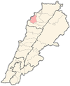
Bdebba
| Bdebba | |
|---|---|
| بدبا | |
 | |
| Country |
|
| Governorate | North Governorate |
| Area | |
| • Total | 0.72 sq mi (1.87 km2) |
| Elevation | 900 ft (290 m) |
| Population | |
| • Total | 1,200 |
| • | 81.5% Greek Orthodox |
| Time zone | EST (UTC+2) |
| • Summer (DST) | +3 (UTC) |
| North | 34° 20' 53" |
| East | 35° 49' 11" |
Bdebba بدبا is a Greek Orthodox village in Koura District of Lebanon.
Etymology
The word Bdebba has Syriac origins and is formed of two parts “Bet Dibba”. “Bet” means “house”(مكان ) and “Dibba” means “bear” (الدب). Hence, Bdebba is the house of the bear(مأوى الدب). This etymological analysis can be supported by archeological finding in the area. Indeed, an excavation by a team from Tokyo University Scientific Expedition to Western Asia in the Keoue area, a river bed that separates Bdebba and Bterram, and the artifacts found led to the conclusion that the occupants of the site were probably big bear hunters using small points.[1][2][3]
Location

The town of Bdebba is located in the Qada’a of Koura in the North governorate at an average altitude of 900 feet (290 meters) above sea level. Bdebba is 45 miles (70 kilometers) north of Beirut 3.5 miles (5.5 kilometers) east of the Mediterranean sea and 6 miles (10 kilometers) south of Tripoli (Trablous) Lebanon 2nd largest city. The town extends over an area of approximately 462 acres, (1'870,000 m²)most of the land is planted with olive trees.
Coordinates
34° 20' 53" North
35° 49' 11" East
Population
The estimated number of registered residents reaches around 1,200 people, with the majority (more than 80%) belonging to the Greek Orthodox church and a minority of Maronite Catholics.
The number of voters reached 859 in 2004, compared with 872 in 2000.
Families

According to the 2004 municipal elections these are the most influetial families in Bdebba:
- Khoury: 150 voters
- Daher: 72 voters
- Jabbour: 60 voters
- Saadeh: 50 voters
- Jreih: 50 voters
- Chikhani: 43 voters
- Moussa: 35 voters
- Abi Saab: 30 voters
- Nemeh: 30 voters
- Armesh: 25 voters
- Sleiman: 20 voters
- Barakat: 20 voters
Other families include: Hajj, Nassar, Ibrahim, Chakkour, Youssef, Fayyad, Qormesh, Ya’acoub, Tannous, Merched, Itani, Ghazi, Razzouk, Maik, Gerges, Derkhashadorian, Allawi, Tarraq, Boustani, and Sassine.
Local authorities
Until 2004 the highest authority in town was the mukhtar (mayor); headed by Lila Khoury and the vice Mayor Georgette Khoury.
Since 2004 municipality was created in Bdebba in line with decision no. 818 of December 30, 2003. The municipal council is formed of 9 members and is headed by Zafer Khoury. The town still has a mukhtar (mayor) and a mayoral council.
Economy
Residents depend on the cultivation of olive, production of olive oil and olive soap, some cultivate fig, grapes, grapefruits, mostly for personal consumption. In addition to that several local businesses were established but few were to shine like "MOON Clothing" owned by Mrs Goergette Khoury since 1987 and located in bichmizzine El koura.
Also the immigrants to the United States of America, Canada, Argentina, Brazil, Mexico, Africa, Saudi Arabia, Kuwait and the other Gulf states send money to their families.
Archeological and cultural sites


Bdebba have ruins that date back to the Phoenician period. Those include ancient caves and sarcophagi. Ruins from the Crusades era were also discovered in the town.
There are also two Greek Orthodox churches and a monastery.
Education
There are no schools in Bdebba, elementary school students go to nearby towns, some students seeking a college degree go to United States or Europe.
There is almost no illiteracy, most residents also speak, French and/or English, and/ or Spanish.
References
- ↑ Dr. Aksam J. Merched. "Bterram Keoue Prehistoric Site: the discoveries". Keoue.bterram.com. Retrieved 2012-05-23.
- ↑ Hitashi Watanabe. The excavation of the Keoue Cave, Lebanon. Interim Report, June 1970. Bulletin du Musee de Beyrouth. Tome XXIII, 1970, Paris
- ↑ "Welcome to Bdebba... a small village in El Koura district of Lebanon". bdebba.org. Retrieved 2012-05-23.
Coordinates: 34°21′N 35°49′E / 34.350°N 35.817°E