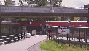
Bayview Station
| Bayview O-Train and Transitway Station | |||||||||||||||||||||||||||||||||||||||||
|---|---|---|---|---|---|---|---|---|---|---|---|---|---|---|---|---|---|---|---|---|---|---|---|---|---|---|---|---|---|---|---|---|---|---|---|---|---|---|---|---|---|
 | |||||||||||||||||||||||||||||||||||||||||
| Station statistics | |||||||||||||||||||||||||||||||||||||||||
| Coordinates | 45°24′33.4″N 75°43′18.9″W / 45.409278°N 75.721917°WCoordinates: 45°24′33.4″N 75°43′18.9″W / 45.409278°N 75.721917°W | ||||||||||||||||||||||||||||||||||||||||
| Platforms | At-grade - single | ||||||||||||||||||||||||||||||||||||||||
| Tracks | 1 | ||||||||||||||||||||||||||||||||||||||||
| Parking | No | ||||||||||||||||||||||||||||||||||||||||
| Bicycle facilities | yes | ||||||||||||||||||||||||||||||||||||||||
| Other information | |||||||||||||||||||||||||||||||||||||||||
| Opened | 2001 | ||||||||||||||||||||||||||||||||||||||||
| Services | |||||||||||||||||||||||||||||||||||||||||
| |||||||||||||||||||||||||||||||||||||||||
Bayview Station is a transitway and O-Train station in Ottawa, Ontario. The bus stop is at the eastern end of Scott Street when it becomes Albert Street. The O-Train station, the northern terminus of the current line, is located on a stub-end track branching off from the railway line, immediately under the Wellington Street and transitway overpasses. Paved asphalt footpaths connect the two stops on opposite sides of the transitway and the train platform.
From the higher points of the station, one can just see the Parliament buildings across the LeBreton Flats.
The station is named for nearby Bayview Road. By 2018, the East-West Transitway between Tunney's Pasture and Blair Station will be converted to light-rail transit, making Bayview an important rapid transit transfer point. It will also be a catalyst for large redevelopment including condos, hotels and the city's tallest office tower at 801 Albert. Plans also exist for converting a 1940's warehouse into a film studio and build an attached 15 storey "innovation hub". The station is close to Tom Brown Arena
Service

The following routes serve Bayview Station:
O-TRAIN
60 61 62 65 66
67
68 69 70 71 73 76 77
86B 86C 87
93
94 95 96
96A
96C
97 98
105 176
261 262 263 283
403
AM ONLY
20 21 22
24
27 30 31 34 35 37 38
41 43 96D
231 232
Note: Route 16 is available on Scott Street.
External links
| |||||||||||||||||||||||||||||||