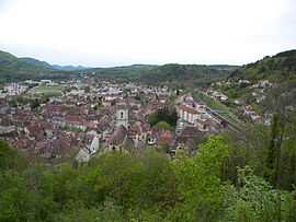
Baume-les-Dames
From Wikipedia, the free encyclopedia
| Baume-les-Dames | ||
|---|---|---|
 | ||
| ||
 Baume-les-Dames | ||
|
Location within Franche-Comté region  Baume-les-Dames | ||
| Coordinates: 47°21′10″N 6°21′39″E / 47.3528°N 6.3608°ECoordinates: 47°21′10″N 6°21′39″E / 47.3528°N 6.3608°E | ||
| Country | France | |
| Region | Franche-Comté | |
| Department | Doubs | |
| Arrondissement | Besançon | |
| Canton | Baume-les-Dames | |
| Intercommunality | Pays Baumois | |
| Government | ||
| • Mayor (2008–2014) | Augustin Guillot | |
| Area | ||
| • Land1 | 24.79 km2 (9.57 sq mi) | |
| Population (2008) | ||
| • Population2 | 5,317 | |
| • Population2 Density | 210/km2 (560/sq mi) | |
| INSEE/Postal code | 25047 / 25110 | |
| Elevation | 261–538 m (856–1,765 ft) | |
|
1 French Land Register data, which excludes lakes, ponds, glaciers > 1 km² (0.386 sq mi or 247 acres) and river estuaries. 2 Population without double counting: residents of multiple communes (e.g., students and military personnel) only counted once. | ||

Baume-les-Dames is a commune in the Doubs department in the Franche-Comté region in eastern France.
Population
| Historical population | ||
|---|---|---|
| Year | Pop. | ±% |
| 1793 | 2,220 | — |
| 1800 | 2,300 | +3.6% |
| 1806 | 2,160 | −6.1% |
| 1821 | 2,173 | +0.6% |
| 1831 | 2,467 | +13.5% |
| 1836 | 2,519 | +2.1% |
| 1841 | 2,543 | +1.0% |
| 1846 | 2,561 | +0.7% |
| 1851 | 2,587 | +1.0% |
| 1856 | 2,615 | +1.1% |
| 1861 | 2,577 | −1.5% |
| 1866 | 2,562 | −0.6% |
| 1872 | 2,463 | −3.9% |
| 1876 | 2,762 | +12.1% |
| 1881 | 2,821 | +2.1% |
| 1886 | 2,841 | +0.7% |
| 1891 | 2,555 | −10.1% |
| 1896 | 2,991 | +17.1% |
| 1901 | 3,134 | +4.8% |
| 1906 | 3,257 | +3.9% |
| 1911 | 3,280 | +0.7% |
| 1921 | 3,147 | −4.1% |
| 1926 | 3,161 | +0.4% |
| 1931 | 3,043 | −3.7% |
| 1936 | 2,898 | −4.8% |
| 1946 | 2,876 | −0.8% |
| 1954 | 3,003 | +4.4% |
| 1962 | 4,038 | +34.5% |
| 1968 | 4,914 | +21.7% |
| 1975 | 5,531 | +12.6% |
| 1982 | 5,303 | −4.1% |
| 1990 | 5,237 | −1.2% |
| 1999 | 5,384 | +2.8% |
| 2008 | 5,317 | −1.2% |
See also
References
External links
- Official website (French)
| Wikimedia Commons has media related to Baume-les-Dames. |
This article is issued from Wikipedia. The text is available under the Creative Commons Attribution/Share Alike; additional terms may apply for the media files.