Batuan, Bohol
| Batuan | |
|---|---|
| Municipality | |
 | |
 | |
.svg.png) Batuan | |
| Coordinates: 9°48′43″N 124°08′39″E / 9.81194°N 124.14417°ECoordinates: 9°48′43″N 124°08′39″E / 9.81194°N 124.14417°E | |
| Country | Philippines |
| Region | Central Visayas (Region VII) |
| Province | Bohol |
| District | 3rd district of Bohol |
| Incorporated | October 31, 1903 |
| Barangays | 15 |
| Government[1] | |
| • Mayor | Francisco Pepito |
| • Vice Mayor | Paulino T. Amper |
| • Councilors |
List
|
| Area[1] | |
| • Total | 78.15 km2 (30.17 sq mi) |
| Population (2010)[2] | |
| • Total | 12,431 |
| • Density | 160/km2 (410/sq mi) |
| Time zone | PST (UTC+8) |
| ZIP code | 6318 |
| Dialing code | 38 |
| Income class | 5th class |
| Website | www.batuan-bohol.lgu.ph |
Batuan is a fifth class municipality in the province of Bohol, Philippines. According to the 2010 census, it has a population of 12,431 people.[2]
Geography
Batuan is 51 kilometres (32 mi) away from Tagbilaran City, and is located in the interior part of the island. It is accessible via the Tagbilaran Loay- Carmen National Road route as first option or the Tagbilaran- Balilihan- Batuan provincial road as an alternative option.
The Municipality of Sagbayan, on the south by the Municipality of Bilar, on the east by the Municipalities of Carmen and Valencia, and on the west by the Municipalities of Catigbian and Balilihan bound on the north.
The municipality of Batuan has a total land area of 7,908 hectares comprising fifteen (15) barangays as per Municipal Comprehensive Development Plan for 1983–1992. However, a certification of the land area of Batuan, issued by ARED for operations, DENR Regional Office Region No. 7 Cebu City on November 26, 2001 at the instance of the LGU in connection with its Comprehensive Land Use Plan (CLUP) preparation work, showed only a total land area of 4,878.4272 hectares, accounting only eleven barangays (11) to the exclusion of four (4) barangays- Quirino, Aloja, Behind the Clouds and Garcia.
Climate
Like most of the municipalities of the province, the climate in Batuan is characterized by not very pronounced maximum rainfall with a short dry season from one (1) to three (3) months and a wet season of nine (9) to ten (10) months. The dry season starts in February and lasts up to April sometimes extending up to the middle of May. The heaviest rainfalls are from June to August. It is usually cold during the night in the area. Batuan is generally out of the typhoon belt area and very seldom experiences typhoon.
Slope
Dominant slope of the area is 30- 50% covering an estimated area of 2,893.85 has or 36.59% of its total land area, with the 0-3% category coming in next occupying a total of 2,081.2559 has or 26%.
River and River Basin
Batuan is entirely within the Loboc River Basin. Two (2) tributaries of Loboc, the Pagbathan and the Bayog River, flow from east to west into the main river course.
Hydrogeology
The entire area of Batuan is covered by two sedimentary rock formations: Maribojoc Limestone, occupying 78.74 km2 or 99.57% of its total land area, and Carmen formation, occupying 0.34 km2 or 0.43 %.
Barangays
Batuan is politically subdivided into 15 barangays.
| Barangay | Area (km²) |
Population (2010)[3] |
Pop. density (per km²) |
|---|---|---|---|
| Aloja | | | |
| Behind the Clouds | | | |
| Cabacnitan | | | |
| Cambacay | | | |
| Cantigdas | | | |
| Garcia | | | |
| Janlud | | | |
| Poblacion Norte | | | |
| Poblacion Sur | | | |
| Poblacion Vieja | | | |
| Quezon | | | |
| Quirino | | | |
| Rizal | | | |
| Rosariohan | | | |
| Santa Cruz | | | |
History
Once a part of the municipality of Bilar, Batuan became a separate municipality in the province of Bohol on October 31, 1903, thru the efforts of some local leaders, such as Manuel Decasa, Alejandro Barril, Victor Tiongson, among others, who were put behind bars for strongly advocating the movement to cede Batuan from its mother town Bilar, and its subsequent creation as a distinct and separate town.
Notwithstanding, these leaders pursued their aspirations with renewed inspiration and determination after their release from prison. Thus amid the strong protestation and opposition of the then municipal officials and Parish Peotest of Bilar, the Municipality of Batuan, by virtue of act No. 968 of the Philippine Commission was created comprising only five (5) original barangays namely: Lindugon, Cambacay, Rosariohan, Janlud and Cantigdas, but to date already composed of fifteen (15) barangays as hereunder shown along with their respective land area, based on the Municipal Comprehensive Development Plan for 1983–1992,
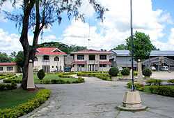
The early years of local administration saw its seat at Lindugon, now Poblacion Vieja. In 1911 however, the Municipal Hall, the seat of local government, was transferred to sitio Tinagacan for reasons of accessibility. Eventually, the parish church was also relocated to its present site at the Poblacion.
Batuan got its name from edible trees of the same nomenclature, which grew galore in the locality. Oddly enough, these trees can hardly be found in the area at present.
During the Japanese occupation, Batuan was a haven of evacuees from the provinces of Cebu, Leyte and from other parts of the island/province. It was at the Batuan Central School site were the unification of the guerilla forces of Bohol was forged on June 29, 1942, paving the way for the creation of the Bohol Area Command (BAC) under the command of the late Major Ismael Ingeniero, whose election was hotly contested by rival factions. The command had its headquarters in barangay Behind the Clouds.
Batuan, located within the provinces tourist belt area, is the gateway to the Chocolate Hills and only about three (3) kilometers away from the Chocolate Hills Complex at Buenos, Aires, Carmen.
Demographics
| Population census of Batuan | ||
|---|---|---|
| Year | Pop. | ±% p.a. |
| 1990 | 11,438 | — |
| 1995 | 11,898 | +0.79% |
| 2000 | 11,835 | −0.11% |
| 2007 | 12,137 | +0.36% |
| 2010 | 12,431 | +0.80% |
| Source: National Statistics Office[2] | ||
Batuan‘s working age or economically active population age 15-64, comprises 58% of its total population, while its dependent population, aged 0–14 and 65 yrs and above, comprising only 42%.
Road network
Batuan has a total road network of about 92.090 kilometres (57.222 mi) of which 65.516 kilometres (40.710 mi) are barangay roads, 15.800 kilometres (9.818 mi) are provincial roads, 3.2 kilometres (2.0 mi) national and 10.77 kilometres (6.69 mi) municipal roads. While the entire national road network is of either concrete or asphalt type, only about 2.3 kilometres (1.4 mi) or 21% of its municipal roads, and about 2.5 kilometres (1.6 mi) or 3% of its barangay roads are concrete with the larger portion still earth and / or gravel. On the other hand, 98% of its provincial roads are of the gravel type.
Telecommunications
There are at present ONE HUNDRED FIFTY (150) more or less Globelines formerly ISLACOM Telephone subscribers (home connections) in the entire BATUAN aside from the modern cellular phones. Where three (3) signals from Smart, Globe & Sun cell sites.
Social services
All barangays have their Day Care centers to boot where day care services are provided by the day care workers on a regular basis, a program financially supported by the LGU aside from other programs like supplemental feeding, Emergency assistance, and burial assistance.
Health
The Municipal Health Office (MHO) is manned by a doctor, five (5) midwives, a nurse, a medical (laboratory) technologist, a sanitary inspector, and a dentist who reports only twice a week due to budget constraints. A team of Barangay Health Workers has been organized in all barangays to help facilitate and speed up the delivery of basic health services even in the remote areas. There are only three (3) Barangay Health stations in the whole area. An ambulance is at stand by for emergency uses.
Protective services
For the maintenance of peace and order in the area, the LGU has a local PNP station headed by a bonafide police chief with ten (20) junior PNP personnel, equipped with some few high-powered firearms & one (1) patrol car. The local PNP force is assisted in this regard by tanod members of each composite barangays as far as peace and order and lawlessness are concerned in the barangay level. The LGU however has no existing or available personnel or equipment for fire protection purposes.
Economy
Agriculture
Basically, Batuan is an agricultural town as more than half of its total land area is devoted to agriculture, about 4,952 has or 63%. This is the main source of livelihood in the locality where a great portion of its income is derived from crop production, livestock and poultry raising. Rice and corn are the principal crops grown in the area. Coconut, fruits root crops and leafy vegetables come next. Despite the absence of effective irrigation facilities, 1,794 hectares are devoted to rice production, with an average production of 60 cavans per hectares. A total of 1,313 has is devoted to corn production. Coffee and cacao are among the industrial crops grown in the locality. Just launched by the LGU is the Fish Culture Farming program designed to encourage to go into small backyard fishponds to address the scarce supply and high costs of fish in the area.
Trade, commerce and industry
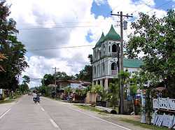
Commercial and trading transactions in Batuan gravitate in the urban area, considered as the towns Central Business District. However, commercial and trading activities in the area are the brisk. Commercial activities in Batuan pass thru a network of various commercial establishments. Sari-sari stores are the most common. Other are bakeries, eateries, drugstores, farm and poultry stores, hardware’s. Service providers in the area are Iron works, welding shops, repair shops, furniture factory & communication facilities. Among the ubiquitous industries of Batuan are the rice and corn mills located mainly at the Poblacion areas. Other than those, industrial activities are minimal.
Education
There are eighteen (18) learning institutions in Batuan of which nine are primary schools, six (6) elementary schools, one (1) public schools and one (1) private high school, providing secondary education. A privately owned college school offering technical and short courses in a close tie-up with TESDA, the Batuan Colleges, has been in operation for 7–8 years.
Tourism
Although Batuan is only about 3 kilometres (1.9 mi) from the Chocolate Hills Complex, tourism activities in the municipality are almost nil. There are no facilities and establishments that cater to the needs and wants of the industry. Batuan also has the Camanayon Mountain. However, the LGU has potentials for Eco- tourism activity that may be tapped for boating, swimming and leisure treks.
Batuan hymn
.jpg)
Awit Sa Batuan (Words and Music by Arnell Baguio):
Bantugan'g yuta'ng tabonon
Angkong lungsod Bol-anon
Nag'sidlak bulawan ang kahumayan
Tikad kamut sa mga kugihan
Ug nagabugwak ang katubigan
Gikan sa gabudlan
Ang Ginoo gipasalamatan
Nagsaulog sa Guimbawan!
Bigkis sa gugma ki'ng lungsod
Abag sa atong nasud
Tubod sa kalinaw kahiusa sa tanan
Ugmad sa katawhan
Ang kalag ug lawas, ihalad ta'ng tanan
Ning mahal ta'ng lungsod - Batuan!
References
- ↑ 1.0 1.1 "Municipality of Batuan". Province of Bohol. Retrieved 2012-09-10.
- ↑ 2.0 2.1 2.2 "Population and Annual Growth Rates by Province, City, and Municipality - Region VII - Central Visayas: 1990, 2000, and 2010". National Statistics Office.
- ↑ "Total Population by Province, City, Municipality and Barangay: as of May 1, 2010". 2010 Census of Population and Housing. National Statistics Office. Retrieved 8 October 2013.
External links
- Bohol
- Municipality of Batuan
- Philippine Standard Geographic Code
- Philippine Census Information
- Municipality of Batuan
- 2007 Philippine Census Information
 |
Sagbayan | | ||
| Catigbian Balilihan |
|
Carmen | ||
| ||||
| | ||||
| Bilar |