Baoruco Province
| Baoruco | |
| Province | |
| Country | |
|---|---|
| Capital | Neiba |
| - elevation | 30 m (98 ft) |
| - coordinates | 18°29′24″N 71°25′12″W / 18.49000°N 71.42000°W |
| Area | 1,282.23 km2 (495 sq mi) |
| Population | 97,313 (2010) [1] |
| Density | 76 / km2 (197 / sq mi) |
| Province since | 1943 |
| Subdivisions | 5 municipalities 9 municipal districts |
| Congresspersons | 1 Senator 2 Deputies |
| Timezone | EST (UTC-4) |
| Area code | 1-809 1-829 1-849 |
| ISO 3166-2 | DO-03 |
| Postal Code | 82000 |
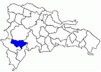 Baoruco in the Dominican Republic
| |
Baoruco, alternatively spelt Bahoruco (Spanish pronunciation: [baoˈɾuko]), is a province of the Dominican Republic. Before 1952 it included what is now Independencia Province.
Important features are the Sierra de Neiba mountain range and Lake Enriquillo.
Municipalities and municipal districts
The province is divided into the following municipalities (municipios) and municipal districts (distrito municipal - D.M.) within them:[2]
|
The following is a sortable table of the municipalities and municipal districts with population figures from the 2012 census. Urban population are those living in the seats (cabeceras literally heads) of municipalities or of municipal districts. Rural population are those living in the districts (Secciones literally sections) and neighborhoods (Parajes literally places) outside of them.[3]
| Name | Total population | Urban population | Rural population |
|---|---|---|---|
| Galván | 15,869 | 7,583 | 8,286 |
| Los Ríos | 9,963 | 4,113 | 5,850 |
| Neiba | 53,605 | 40,014 | 13,591 |
| Tamayo | 25,988 | 10,099 | 15,889 |
| Villa Jaragua | 13,562 | 10,558 | 3,004 |
| Baoruco province | 118,987 | 64,813 | 54,174 |
For comparison with the municipalities and municipal districts of other provinces see the list of municipalities and municipal districts of the Dominican Republic.
References
- ↑ "IX Censo Nacional de Población y Vivienda 2010." (PDF) (in Spanish). Oficina Nacional de Estadística. June 2012. Retrieved 23 September 2013.
- ↑ Oficina Nacional de Estadistica, Departamento de Cartografia, Division de Limites y Linderos. "Listado de Codigos de Provincias, Municipio y Distritos Municipales, Actualizada a Junio 20 del 2006" (in Spanish). Retrieved 2007-01-24.
- ↑ Consejo Nacional de Población y Familia. "Censos y Proyecciones de la Población Dominicana por Regiones, Provincias, Municipios y Distritos Municipales, 2012" (PDF) (in Spanish). Retrieved 2012-01-11.
External links
- Jaragua-Bahoruca-Enriquillo Reserve
- (Spanish) Oficina Nacional de Estadística, Statistics Portal of the Dominican Republic
- (Spanish) Oficina Nacional de Estadística, Maps with administrative division of the provinces of the Dominican Republic, downloadable in PDF format