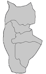
Baniyas
| Baniyas بانياس | |
|---|---|
 | |
 Baniyas | |
| Coordinates: 35°10′56″N 35°56′25″E / 35.18222°N 35.94028°E | |
| Country |
|
| Governorate | Tartus Governorate |
| District | Baniyas District |
| Population (2008 est.) | |
| • Total | 42,128 |
| Time zone | EET (UTC+2) |
| • Summer (DST) | +3 (UTC) |
| Area code(s) | 43 |
Baniyas (Arabic: بانياس Bāniyās) is a city in Tartous Governorate, northwestern Syria, located at the foot of the hill of Qalaat el-Marqab (housing the Crusade castle of Marqab, Margat in western sources), 55 km to the south of Latakia (ancient Laodicea) and 35 km north of Tartous (ancient Tortosa), and a Catholic titular see under the Latin name of Balanea, which is now vacant.
It is famous for its orchards and its export of wood. Today it is best known for its oil refinery north of the city, one of the largest in Syria; a power station is also present.
It still contains citrus fruit orchards surrounded by green hills. One of the hills has at its top the imposing Margat Citadel, a huge Knights Hospitaller fortress built with black basalt stone.
History
In Phoenician times, it was an important seaport, known to the Greeks as Balemia. Perhaps in Hellenistic times the city borrowed the name Leucas (according to Stephanus Byzantius) from the island in western Greece. The city of Balanaea, its Latin name, was a colony of Aradus (Strabo, XVI, 753), and was placed by Stephanus Byzantius in Phoenicia, though it belonged rather to the former Roman province of Syria. Its first known bishop was present at the Council of Nicaea in 325 (Lequien, Oriens Christ., II, 923).
During the Syrian civil war rebel sources reported that a massacre took place on 2 May 2013, perpetrated by government forces. "Syrian troops, backed by gunmen from nearby Alawite villages, swept into the town, torched homes and used knives, guns and blunt objects to kill people in the streets."[1]
References
- ↑ "Syrians flee 'massacres' in Baniyas and al-Bayda," BBC (4 May 2013). Retrieved 6 May 2013.
External links
 "Nicolò Arrighetti". Catholic Encyclopedia. New York: Robert Appleton Company. 1913.
- GCatholic.org- Titular Sees
![]() This article incorporates text from a publication now in the public domain: Herbermann, Charles, ed. (1913). "Balanaea". Catholic Encyclopedia. Robert Appleton Company.
This article incorporates text from a publication now in the public domain: Herbermann, Charles, ed. (1913). "Balanaea". Catholic Encyclopedia. Robert Appleton Company.
Coordinates: 35°10′56″N 35°56′25″E / 35.18222°N 35.94028°E
| |||||||||||||||||||||||||||||||||||||||||||||||||||

