Banepa
| Banepa भोंत | |
|---|---|
| Town | |
 | |
 Banepa | |
| Coordinates: 27°38′N 85°31′E / 27.633°N 85.517°ECoordinates: 27°38′N 85°31′E / 27.633°N 85.517°E | |
| Country |
|
| Zone | Bagmati Zone |
| District | Kavrepalanchok District |
| Population (1991) | |
| • Total | 12,537 |
| Post code | 45210 |
| Area code(s) | 011 |
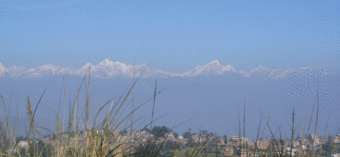
Banepa (Nepal Bhasa: भोंत) is a Municipality town located 26 km east of Kathmandu, Nepal. At the time of the 1991 Nepal census, it had a population of 12537 and had 1956 households in it.[1] The main attraction of Banepa is the temple of Chandeshwori, located approximately 1 km northeast of the town along the Rudramati River. The Dhaneshwor Temple is 1 km south of the town. Also Banepa is well known for its eight different temples of Lord Ganesh, Narayanthan, the temple of lord Narayan, Bhimshenthan, the temple of Lord Bhimshen and eight different ponds. A lot of festivals are celebrated in Banepa, including the Chandeshwori Jatra, the kanya-puja (worshipping of the young girls), Nawadurga Jatra (Fish-catching festival), Ganesh Jatra, and Bhimshen Jatra.
Banepa has a Seventh-day Adventist hospital called Scheer Memorial Hospital, which was established in 1957. This hospital has been expanded as a medical college associated with Vanderbilt University in the USA and Kathmandu University. Many students enroll in the MBBS and B.Sc. Nursing programs at this hospital. Banepa is also the location of the Hospital and Rehabilitation Centre for Disabled Children (HRDC). HRDC is a program of a non-governmental organization, the Friends of the Disabled. It is the only hospital in the country that provides tertiary-level care, and it provides the best reconstructive surgery and rehabilitation for children below 16 years of age. Its services are aimed at under-privileged, physically challenged children in Nepal.
The Information Technology Park is being built on the borders of three municipalities: Kavre; Banepa, Dhulikhel and Panauti. There is debate about the official placement. All three towns are designated as cyber cities.
Banepa is also a major trade route to Tibet, with the Arniko Rajmarg, the only highway that connects Nepal and China (Tibet), running through this town. Furthermore, another newly constructed highway, the B.P. Koirala Highway (named after great leader of Nepal Bishweswor Prasad Koirala), also passes through this town. Though it is a small town, Banepa is the major economic center east of Kathmandu.
Media
To Promote local culture Banepa has one FM radio station Radio ABC - 89.8 MHz Which is a Community radio Station.
Education
Banepa is also the best place for education in Kavre district of Nepal. There are a number of high schools and colleges. The oldest school of the district Azad Secondary School, Chaitanya Secondary School, Siksha Sadan Secondary School, Himalaya Secondary School and some of the well-known private boarding schools are Gyan Sarovar English Boarding Secondary School (estd. in 1988), Banepa Valley School, Siddhartha English Higher Secondary School, Bal Niketan English Boarding School, Vidhya Sagar Secondary School, Bal Batika Vidhya Mandir High School, Kavre Secondary School, Bagmati English Boarding School, Pragati Pravat higher secondary school and RMS(Rambhakta Memorial School)(estd in 2005). Among them the oldest private school is Pragati Prabhat School and the newest one is RMS(Rambhakta Memorial School)
References
- ↑ "Nepal Census 2001". Nepal's Village Development Committees. Digital Himalaya. Archived from the original on 12 October 2008. Retrieved 2008-09-01.

