Bakhtegan Lake
From Wikipedia, the free encyclopedia
| Lake Bakhtegan | |
|---|---|
 | |
| Coordinates | 29°21′55″N 53°50′19″E / 29.3654°N 53.8385°ECoordinates: 29°21′55″N 53°50′19″E / 29.3654°N 53.8385°E |
| Type | salt lake |
| Primary inflows | Kor River |
| Basin countries | Iran |
| Surface area | 3500 km² |
| Islands | Menak Island |
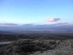
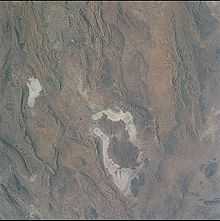
Lake Bakhtegan (Persian: دریاچۀ بختگان) is a salt lake in Fars Province, southern Iran, about 160 km (99 mi) east of Shiraz and 15 km (9.3 mi) west of the town of Neyriz.
Bakhtegan, with a surface area of 3,500 square kilometres (1,400 sq mi), is Iran's second-largest lake. It is fed by the Kor River.[1] Several dams on the Kor River have significantly reduced waterflow into the lake, increasing its salinity and endangering the lake's populations of flamingos and other migratory birds.[1] Lake Bakhtegan is now completely dry due to the dams built on the Kor River by the Islamic regime.
References
External links
| Wikimedia Commons has media related to Bakhtegan Lake. |
This article is issued from Wikipedia. The text is available under the Creative Commons Attribution/Share Alike; additional terms may apply for the media files.
