Bagley Icefield

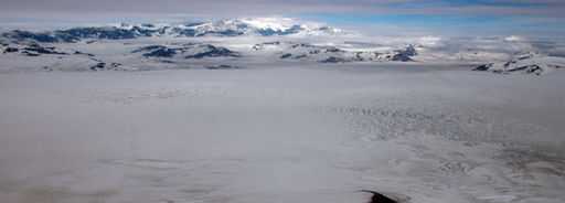
The Bagley Icefield (also called Bagley Ice Valley) in southeastern Alaska is the largest nonpolar icefield in North America. It was named after James W. Bagley, a USGS topographic engineer who developed the Bagley T-3 camera and mapped Alaska prior to World War I.[1] At 200 km (127 mi) long, 10 km (6 mi) wide, and up to 1 km (3,000 ft) thick, it covers most of the core of the Saint Elias Mountains and part of the Chugach Mountains.[2] It nourishes dozens of valley glaciers that drain down both sides of the range, including the Tana, Miles, and Guyot glaciers. The area of the combined Bagley Icefield and Bering Glacier System, including tributaries, is 5,200 km² (1,900 sq mi).
19th-century explorers attempting to climb Mt. St. Elias, including Luigi Amedeo, Duke of the Abruzzi, who successfully made the first ascent in 1897, did not recognize that the huge glacier now named Bagley Icefield actually forms the upper reaches of the distant and similarly vast Bering Glacier, which had been named earlier, after observation from the coast.[3]
The glacier is protected within the boundaries of the Wrangell-St. Elias National Park and Preserve.
See also
References
- ↑ Molnia, Bruce; Post, Austin (2010), "Introduction to the Bering Glacier System, Alaska/Canada: Early observations and scientific investigations, and key geographic features", in Shuchman, Robert; Josberger, Edward, Bering Glacier: Interdisciplinary Studies of Earth's Largest Temperate Surging Glacier, Boulder, Colorado: Geological Society of America, pp. 13–42, ISBN 978-0-8137-2462-1
- ↑ "Wrangell-St. Elias National Park & Preserve Glaciers". U.S. National Park Service. Archived from the original on 29 May 2010. Retrieved 2010-06-14.
- ↑ "Dynamic Behavior of the Bering Glacier-Bagley Icefield System During a Surge". European Space Agency. Retrieved 2010-06-14.
Coordinates: 60°29′01″N 141°35′01″W / 60.48361°N 141.58361°W