Badulla District
| Badulla District | |
|---|---|
| Administrative District | |
 | |
 | |
 | |
| Coordinates: 6°59′05″N 81°03′23″E / 6.98472°N 81.05639°ECoordinates: 6°59′05″N 81°03′23″E / 6.98472°N 81.05639°E | |
| Country |
|
| Province | Uva Province |
| Largest City | Badulla |
| Divisions |
List
|
| Government | |
| • Governor | Hon. C. Nanda Mathew |
| • Chief Minister of Uva Provincial Council | Hon. Shashindra Rajapakse |
| • Secretary of District | Rohana Keerthi Dissanayake. |
| • Headquarters | Badulla Districts Secretariat |
| Area | |
| • Total | 2,861 km2 (1,105 sq mi) |
| Population (2006) | |
| • Total | 837,000 |
| • Density | 290/km2 (760/sq mi) |
| Time zone | Sri Lanka (UTC+05:30) |
| ISO 3166 code | LK-81 |
| Languages | Sinhala, Tamil, English |
| Website | ds.gov.lk/dist_badulla |
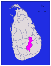
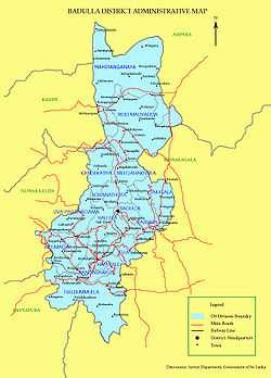
Badulla is a district in Uva Province, Sri Lanka. The entire land area of the Badulla district is 2,861 km² and total population is 837,000. The district is bounded by the districts of Monaragala and Rathnapura on the East & South, by Ampara and Kandy districts on the North and by Nuwara Eliya and Matale on the West. Mainly the economy of the district is based on agricultural farming and livestock.
Badulla District is an agricultural district where tea, vegetable and paddy are cultivated. Mainly the district is divided into two portions as Upper region and Lower region according to climatic and geographical characteristics. Upper division of the district is famous for tea plantation and vegetable cultivation while lower division is famous for paddy cultivation.[1] [2]
Education
S.Thomas' College Bandarawela, Bandarawela Central College, Dharmadutha College, UVA College, Badulla Central College, Vishaka Girls High School, Viharamahadevi Girls School, Passara National College, Passara Tamil National College, Sri Ramakrishna College, Al Adhan Maha Vidyalaya and Saraswathy Central College are situated in this district.
Electorate Divisions in Badulla District
- Badulla
- Bandarawela
- Hali-Ela
- Haputale
- Mahiyanganaya
- Passara
- Uva-Paranagama
- Welimada
- Wiyaluwa
Major Cities
- Badulla (Municipal Council)
Big Towns
- Bandarawela (Municipal Council)
Other Towns
- Haputale UC
- Mahiyanganaya
- Diyatalawa
- Hali-Ela
- Ella
- Haldummulla
- Beragala
- Welimada
- Kandaketiya
- Meegahakivula
- Passara
- Lunugala
- tennapanguwa
Demography
(2010 estimates 887220)
Population by Religion
Budhists 612944 Hindus 170673 Muslims 81020 Roman Catholics 16396 Other Christians 6187
Population by Religion %
Budhists 69.08 Hindus 19.24 Muslims 9.13 Roman Catholics 1.85 Other Christians 0.70
Important Locations in Badulla District

- Mahiyangana Raja Maha Viharaya
- Muthiyangana Raja Maha Viharaya, Badulla
- Army Garrison Town, Diyatalawa
- Namunukula Mountain Range
- Lipton's Seat and Adisham Bunglow in Haputale
- Railway bridge and Railway line in Demodara
- Babarakanda, Diyaluma and Ravana Ella Waterfalls
- Bogoda Wooden Bridge
- Indigenous Vedda people, Dambana
Maps
See also
- History of Uva Province
- Health Care of Uva Province - Provincial General Hospital - Badulla
References
| |||||||
.jpg)