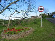
Auchencrow
| Auchencrow | |
 Auchencrow | |
| OS grid reference | NT8560 |
|---|---|
| Council area | Scottish Borders |
| Country | Scotland |
| Sovereign state | United Kingdom |
| Post town | Duns |
| Dialling code | 01890 |
| Police | Scottish |
| Fire | Scottish |
| Ambulance | Scottish |
| EU Parliament | Scotland |
| UK Parliament | Berwickshire, Roxburgh and Selkirk |
| Scottish Parliament | Ettrick, Roxburgh and Berwickshire |

Auchencrow (Scottish Gaelic: Allt na Crà) is a small village in the Scottish Borders area of Scotland, by the Lammermuir range of hills, and near Reston.
Etymology
The modern name, Auchencrow, tends to obscure the question of origins. A Gaelic origin is accepted by Watson (1926, 138) and Nicholaisen (1976, 138). It is thought that the meaning is "achaidh na cra" "field of the tree or trees" This is apparently contradicted by the 12th-century name-form ‘Alden-’, also preserved, for example, in four 13th-century Durham charters. Mac an Tàilleir suggests the form Aldenacraw may be derived from a name for the watercourse (such as the Gaelic Allt na Crà "stream of the salmon trap") rather than the settlement itself.[1]

Something like ‘Halden’s Grave’ or ‘Halden’s Grove’ could be nearer the original idea, but it is more natural to use the current name, and to speak of the village of Auchencrow. This is itself a form only recently derived by folk-etymology from the much longerrunning ‘Edencraw’ or ‘Auchencrawe’: an evolution from Halden- to Alden- or Eden- to Auchenand from -grove/ -grave to -crawe to -crow.[citation needed]
James Hutton, the founder of modern geology, farmed two miles to the west. A James Hutton Trail was established in 2006.
Billie Mains and Tower

South of Auchencrow towards Chirnside, during the war of the Rough Wooing, Billie was burnt in May 1544 during the withdrawal of Lord Hertford's army from Edinburgh.[2] The castle tower, "Byllye tower 9 miles from Berwick on the edge of Lammermore, between Angus's barony of Boncle, and Coldingham" (55°49′48″N 2°14′24″W / 55.8299°N 2.2400°W), was captured on Candlemass day in January 1548 by the English soldier Thomas Carlile, who overcame the guard with 10 companions dressed "in maner of Skottes." He garrisoned the tower with 50 horsemen.[3]
Billie Castle was mentioned with two other neighbouring strongholds Bonkyll Castle and Blanerne Castle in a prophetic rhyme referring to their construction in the time of David I;
Bunkle, Billie and Blanerne
Wi Scotland's Croun
Three castles strong as irne,
Built when Davie was a Bairn,
Theyll all gang doon,
An ilka ane shall be a cairn.
Berwickshire rhymes
Auchencrow and Billie were mentioned in place-name verses recorded in the 19th century;I stood upon Eyemouth Fort,Although the 19th-century editor considered the latter verse of recent origin, he noted "Jamie Bour" as a reference to the servant of Robert Logan of Restalrig and Fast Castle mentioned in the Gowrie Conspiracy trial in 1608, who had property in the village.
And guess ye what I saw,
Ferneyside, and Flemington,
Newhouses, and Cocklaw,
The fairy-folk o' Fosterland,
The witches o' Edencraw,
And the bogle in the Billy-myre.
and among verses referring to witches and warlocks;
Bourtrees, Bees, and Bairns,
Are rife in Auchencraw,
Where in the days o' auld lang syne,
The wives were witches a',
And Jamie Bour the auld gley'd carle,
Was warlock in yon raw.[4]
See also
References
- ↑ Mac an Tàilleir, Iain (2003) Placenames. (pdf) Pàrlamaid na h-Alba. Retrieved 5 March 2010.
- ↑ Billie Castle on RCAHMS Canmore
- ↑ Calendar State Papers Scotland, vol.1 (1898), 68, 70
- ↑ Henderson, George, The popular rhymes, sayings, and proverbs of the county of Berwick, (1856), 2, 52-60
External links
- RCAHMS record on Auchencrow Mains
- Gazetteer for Scotland
- In the territory of Auchencrow: long continuity or late development in early Scottish field-systems?
- Image of Auchencrow
| |||||