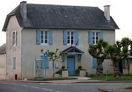
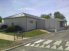
Andoins
| Andoins | ||
|---|---|---|
 | ||
| ||
 Andoins | ||
|
Location within Aquitaine region  Andoins | ||
| Coordinates: 43°18′20″N 0°13′39″W / 43.3056°N 0.2275°WCoordinates: 43°18′20″N 0°13′39″W / 43.3056°N 0.2275°W | ||
| Country | France | |
| Region | Aquitaine | |
| Department | Pyrénées-Atlantiques | |
| Arrondissement | Pau | |
| Canton | Morlaàs | |
| Intercommunality | Pays de Morlaàs | |
| Government | ||
| • Mayor (2008–2014) | Isabelle Lahore | |
| Area | ||
| • Land1 | 12.22 km2 (4.72 sq mi) | |
| Population (2009) | ||
| • Population2 | 625 | |
| • Population2 Density | 51/km2 (130/sq mi) | |
| INSEE/Postal code | 64021 / 64420 | |
| Elevation |
255–357 m (837–1,171 ft) (avg. 342 m or 1,122 ft) | |
|
1 French Land Register data, which excludes lakes, ponds, glaciers > 1 km² (0.386 sq mi or 247 acres) and river estuaries. 2 Population without double counting: residents of multiple communes (e.g., students and military personnel) only counted once. | ||
Andoins is a French commune in the Pyrénées-Atlantiques department in the Aquitaine region of southwestern France.
The inhabitants of the commune are known as Andosiens or Andosiennes[1]
Geography
Location


The commune is part of the urban area of Pau and is located 5 km east of Pau (five miles), the commune is part of the Vic-Bilh region of Gascony.
Access
The commune is traversed by the A64 autoroute however there is no exit in the commune. The nearest exit is Exit 11 just south-east of the commune. Access to the village is by the D39 road from Morlaàs in the north-west which continues south-east to Limendous. There is also the D538 which goes north-west from the village to Serres-Morlaàs. There is also the D215 which goes south-west from the village to Artigueloutan.[2]
Hydrography
Located in the watershed of the Adour, the commune is traversed from south-east to north-west by the Luy de France which forms part of the northern border before continuing to join the Lucet east of Morlaàs.
The Ayguelengue forms the southern border of the commune before joining the Oussere and continuing west.[2]
Localities and hamlets[3]
Neighbouring communes and villages[2]
 |
Serres-Morlaàs | Ouillon | Espéchède |  |
| Sendets | |
Eslourenties-Daban | ||
| ||||
| | ||||
| Ousse | Artigueloutan | Limendous |
Toponymy
The name Andoins appears in the forms:
- Andongns and Andongs (respectively 11th century and 1101,[5] cartulary of Morlaàs)
- Andons (12th century,[5] cartulary of Lescar[6])
- Andoniœ (1270,[5] cartulary of Pau castle[7])
- Andonhs (13th century,[5] Fors de Bearn[8])
- Andoyns (14th century,[5] Béarn census[8])
Its name in Béarnese dialect is Andonsh[9] (according to the classical norm of Occitan).
Brigitte Jobbé-Duval[9] indicates that the village's name probably comes from the family name Antonius, modified in basque to Anton plus the suffix -tz inducing the property of or the domain of Anton.
Aus-Cités was a hamlet in Andoins mentioned in 1863[5] in the Topographic Dictionary of Basque Béarn-Pays. Freitet was a forest in the commune in 1863[5] and was cited in 1457[5] 6 in the cartulary of Ossau.[10]
Hourcade was a fief of Andoins mentioned with the spelling La Forcade in 1385[5] (Béarn census[8]).
Marque-Debat was a hamlet in Adoins reported by the dictionary in 1863 as Marque-Dehore.[5]
Pé-deu-Boscq was a farm in the commune cited in 1863[5] by the Topographic Dictionary of Basque Béarn-Pays.
History
Paul Raymond noted that Andoins was the seat of a barony the same as Limendous.
In 1385 there were 20 fires in Andoins and it depended on the Bailiwick of Pau.
The town was part of the archdeaconry of Vic-Bilh, which depended on the bishopric of Lescar of which Lembeye was the capital.[5]
Heraldry
 |
Blazon: |
Administration
List of Successive Mayors[11]
| From | To | Name | Party | Position |
|---|---|---|---|---|
| 1995 | 2001 | Jean Gabaix | ||
| 2001 | 2014 | Isabelle Lahore | MoDem |
(Not all data is known)
Intercommunality
Andois is part of six intercommunal structures:[12]
- the public agency for local management;
- the Community of Communes of Pays de Morlaàs;
- the AEP association of the Ousse Valley;
- the energy association for Pyrénées-Atlantiques;
- the intercommunal association for consolidation of the communes of the plain of Ousse;
- the intercommunal association for the construction of the rescue centre at Soumoulou.
Demography
In 2009 the commune had 625 inhabitants. The evolution of the number of inhabitants is known through the population censuses conducted in the commune since 1793. From the 21st century, a census of communes with fewer than 10,000 inhabitants is held every five years, unlike larger towns that have a sample survey every year.[Note 1]
| 1793 | 1800 | 1806 | 1821 | 1831 | 1836 | 1841 | 1846 | 1851 |
|---|---|---|---|---|---|---|---|---|
| 510 | 446 | 404 | 542 | 555 | 539 | 538 | 558 | 568 |
| 1856 | 1861 | 1866 | 1872 | 1876 | 1881 | 1886 | 1891 | 1896 |
|---|---|---|---|---|---|---|---|---|
| 550 | 556 | 519 | 527 | 522 | 506 | 546 | 512 | 514 |
| 1901 | 1906 | 1911 | 1921 | 1926 | 1931 | 1936 | 1946 | 1954 |
|---|---|---|---|---|---|---|---|---|
| 454 | 475 | 419 | 368 | 380 | 382 | 354 | 315 | 319 |
| 1962 | 1968 | 1975 | 1982 | 1990 | 1999 | 2006 | 2009 | - |
|---|---|---|---|---|---|---|---|---|
| 329 | 418 | 333 | 469 | 514 | 522 | 603 | 625 | - |
Sources : Ldh/EHESS/Cassini until 1962, INSEE database from 1968 (population without double counting and municipal population from 2006)
Culture and Heritage
Civil heritage
The remains of a fortified complex[13] from the 11th century is evidence of the ancient past of the commune.
Andoins also has a set of dwellings and farms[4] dating to the 18th, 19th, and 20th centuries.
Religious heritage
The Church of Saint-Laurent[14] dates to the 19th century. It contains furniture,[15] stained glass,[16] paintings,[17] statues,[18] and objects[19] registered in the General Inventory of Cultural Heritage.
Notable people linked to the commune
The funerary monument[20] to Guilhem Arnaud, the Baron of Andoins who died in 1301 is displayed in the church of the Commandery of Caubin in the commune of Arthez-de-Béarn.
See also
Notes and references
Notes
- ↑ At the beginning of the 21st century, the methods of identification have been modified by law No. 2002-276 of 27 February 2002 , the so-called "law of local democracy" and in particular Title V "census operations" which allow, after a transitional period running from 2004 to 2008, the annual publication of the legal population of the different French administrative districts. For communes with a population greater than 10,000 inhabitants, a sample survey is conducted annually, the entire territory of these communes is taken into account at the end of the period of five years. The first "legal population" after 1999 under this new law came into force in 1 January 2009 and was based on the census of 2006.
References
- ↑ Inhabitants of Pyrénées-Atlantiques (French)
- ↑ 2.0 2.1 2.2 Google Maps
- ↑ Géoportail, IGN, consulted on 3 November 2011 (French)
- ↑ 4.0 4.1 4.2 4.3 French Ministry of Culture Notices: IA00026873 Dwellings and Farms, IA00026878, IA00026877, IA00026876, IA00026875, IA00026874, IA00026887 (French)
- ↑ 5.0 5.1 5.2 5.3 5.4 5.5 5.6 5.7 5.8 5.9 5.10 5.11 5.12 5.13 5.14 Paul Raymond, Topographic Dictionary of Basque Béarn-Pays (French)
- ↑ Cartulary of the Bishop of Lescar, published in the proof of the History of Béarn by Pierre de Marca (French)
- ↑ Manuscripts in two volumes, 17th century - Departmental archives of Pyrénées-Atlantiques (French)
- ↑ 8.0 8.1 8.2 Manuscript from the 14th century - Depart,mental archives of Pyrénées-Atlantiques (French)
- ↑ 9.0 9.1 Brigitte Jobbé-Duval, Dictionary of placenames - Pyrénées-Atlantiques, 2009, Archives and Culture, ISBN 978-2-35077-151-9 (French)
- ↑ Cartulary of Ossau or red book - Manuscript from the 15th century - Departmental archives of Pyrénées-Atlantiques
- ↑ List of Mayors of France
- ↑ Intercommunality of Pyrénées-Atlantiques, Cellule informatique préfecture 64, consulted on 9 November 2011 (French)
- ↑ French Ministry of Culture Notice IA00026881 Fortified complex (French)
- ↑ French Ministry of Culture Notice IA00026879 Church of Saint-Laurent (French)
- ↑ French Ministry of Culture Notice IM64000474 Furniture in the Church of Saint-Laurent, IM64000473, IM64000472, IM64000462, IM64000461, IM64000460, IM64000459, IM64000458, IM64000457, IM64000456, IM64000455, IM64000453, IM64000452, IM64000451, IM64000450 (French)
- ↑ French Ministry of Culture Notice IM64000454 The stained glass at the Church of Saint-Laurent (French)
- ↑ French Ministry of Culture Notice IM64000463 Paintings (French)
- ↑ French Ministry of Culture Notice IM64000464 Statues in the Church of Saint-Laurent, IM64000454 (French)
- ↑ French Ministry of Culture Notice IM64000471 Objects in the Church of Saint-Laurent, IM64000470, IM64000469, IM64000468, IM64000466, IM64000465 (French)
- ↑ French Ministry of Culture Notice IM64000038 Funerary monument of Guilhem Arnaud (French)
| Wikimedia Commons has media related to Andoins. |