Almaty Province
| Almaty Province Алматы облысы Алматинская область | ||
|---|---|---|
| Province | ||
 | ||
| ||
_in_Kazakhstan.svg.png) | ||
| Coordinates: 45°0′N 78°0′E / 45.000°N 78.000°ECoordinates: 45°0′N 78°0′E / 45.000°N 78.000°E | ||
| Country | Kazakhstan | |
| Capital | Taldykorgan | |
| Government | ||
| • Akim | Ansar Musakhanov | |
| Area[1] | ||
| • Total | 223,924 km2 (86,458 sq mi) | |
| Population (2013-02-01)[2] | ||
| • Total | 1,949,837 | |
| • Density | 8.7/km2 (23/sq mi) | |
| Time zone | East (UTC+6) | |
| • Summer (DST) | not observed (UTC+6) | |
| Postal codes | 040000 | |
| Area codes | +7 (727), +7 (728) | |
| ISO 3166 code | KZ-ALM | |
| Vehicle registration | 05, B | |
| Districts | 16 | |
| Cities | 10 | |
| Townships | 15 | |
| Villages | 769 | |
| Website | zhetysu.gov.kz | |

Almaty (Kazakh: Алматы облысы, Almatı oblısı; Russian: Алматинская область) is a province of Kazakhstan. Its capital is Taldykorgan, which has a population of 123,000. Population of the province: 1,807,894 (2009 Census results);[3] 1,557,269 (1999 Census results).[3]
Geography
Almaty Province is the province which surrounds the city of Almaty. The province borders Kyrgyzstan and Xinjiang in the People's Republic of China. The province also touches three other Kazakh provinces: Jambyl Province to the west, Karagandy Province to the northwest and East Kazakhstan Province to the north. Almaty Province has an area of 224,000 square kilometres.
Much of the northwestern border of the province runs along Lake Balkhash, whose main affluent, the Ili River, is the most significant river of the province. In the province's northeast, it shares the four lakes of the Alakol Depression (Lakes Alakol, Sasykkol, Koshkarkol, and Zhalanashkol) with East Kazakhstan Province. Other lakes within the province include Bartogai and Kapshagay lakes, Lake Issyk, Kaindy and Kolsai lakes.
The Trans-Ili Alatau branch of the Tian Shan Mountains extends from China and Kyrgyzstan into Almaty Province, along its southern border with Kyrgyzstan. Farther to the northeast, the Dzungarian Alatau runs along the province's border with China.
The Charyn Canyon is one of the region's famous scenic spots.
History
Alma-Ata Province, the predecessor of today's Almaty Province, was created from the historical region of Zhetysu on March 10, 1932. Its capital was Alma-Ata (Almaty). Several times during the Soviet period, the north-eastern part of the province, centered on Taldykorgan, was separated from Alma-Ata Province, forming a separate Taldy-Kurgan Province, only to be merged into Alma-Ata Province again several years later.
In April 2001 the administrative center of Almaty Province was moved from Almaty to Taldykorgan. Thus Taldykorgan has become a provincial capital again - this time without splitting a province.
Administrative divisions
The province is administratively divided into sixteen districts and the cities of Kapchagay, Taldykorgan, and Tekeli.[4]
- Aksu District, with the administrative center in the settlement of Zhansugirov;
- Alakol District, the town of Usharal;
- Balkhash District, the selo of Bakanas;
- Enbekshikazakh District, the town of Esik;
- Eskeldi District, the settlement of Karabulak;
- Ile District, the settlement of Otegen Batyr;
- Karasay District, the town of Kaskelen;
- Karatal District, the town of Ushtobe;
- Kerbulak District, the settlement of Saryozek;
- Koksu District, the settlement of Balpyk Bi;
- Panfilov District, the town of Zharkent;
- Raiymbek District, the selo of Kegen;
- Sarkand District, the town of Sarkand;
- Talgar District, the town of Talgar;
- Uygur District, the selo of Chundzha;
- Zhambyl District, the selo of Uzynagash.
Demographics
In the 1989 census (excepting Alma-Ata) Kazakhs 54.2% Russians 28.6% Uigurs 7.8% Others 9.4% .
In the 1999 census (excepting Almaty) Kazakhs 66.4% Russians 23.8% Uigurs 7.0% Others 4.6% .
In the 2009 census (excepting Almaty) Kazakhs 68.2% Russians 22.8% Uigurs 6.2% Other 3.8%
Sights
- Besqaynar - Ski resorts located 1500 metres above sea level
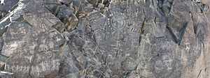
- Tamgaly - a World Heritage Site (petroglyphs)
- Charyn Canyon - Charyn National Park
- Talgar - a region where the Issyk kurgan is located
- Medeo - one of the most famous ice rinks in the world
- Dostyk - a point of entry from China to Kazakhstan
- Kapchagay Dam on the Ili River
References
- ↑ Official site - Basic Information
- ↑ Agency of statistics of the Republic of Kazakhstan: Численность населения Республики Казахстан по областям с началa 2013 года до 1 февраля 2013 года (russisch; Excel-Datei; 55 kB).
- ↑ 3.0 3.1 "Население Республики Казахстан" (in Russian). Департамент социальной и демографической статистики. Retrieved 8 December 2013.
- ↑ "Регионы области" (in Russian). The official portal of akimat of Almaty Region. Retrieved 7 August 2013.
External links
 |
Karagandy Province | East Kazakhstan Province | | |
| Jambyl Province | |
| ||
| ||||
| | ||||
| Chuy Province, |
Issyk Kul Province, |
| ||||||||||
