Žiar nad Hronom
| Žiar nad Hronom | ||
| Town | ||
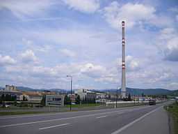
 Aluminium processing plant in Žiar nad Hronom | ||
|
||
| Country | Slovakia | |
|---|---|---|
| Region | Banská Bystrica | |
| District | Žiar nad Hronom | |
| Tourism region | Pohronie | |
| River | Hron | |
| Elevation | 265 m (869 ft) | |
| Coordinates | 48°35′03″N 18°51′39″E / 48.58417°N 18.86083°E | |
| Area | 39.06 km2 (15.08 sq mi) | |
| Population | 19,750 (31 December 2005) | |
| Density | 506 / km2 (1,311 / sq mi) | |
| First mentioned | 1075 | |
| Mayor | Peter Antal (independent) | |
| Timezone | CET (UTC+1) | |
| - summer (DST) | CEST (UTC+2) | |
| Postal code | 965 01 | |
| Area code | +421-45 | |
| Car plate | ZH | |
  Location of Žiar nad Hronom in Slovakia
| ||
  Location of Žiar nad Hronom in the Banská Bystrica Region
| ||
| Wikimedia Commons: Žiar nad Hronom | ||
| Statistics: MOŠ/MIS | ||
| Website: www.ziar.sk | ||
Žiar nad Hronom (German: Heiligenkreuz, Hungarian: Garamszentkereszt, until 1920 Svätý Kríž and until 1955 Svätý Kríž nad Hronom) is a town in Banská Bystrica Region, Slovakia.
Geography
It is located in the Žiar Basin, on the Hron river, around 40 km from Banská Bystrica and 170 km from Bratislava. In addition to the main settlement with in 1969 annexed Horné Opatovce village, the town also has "parts" of Šášovské Podhradie (annexed 1971). Žiar nad Hronom district was named after this city. Average year temperature is 8°C, with often rainfall. Letné teploty sa pohybujú medzi 25°C až 35°C.
History
The first written record about area was in 1075 in a document of Benedictine abbey in Hronský Beňadik. A settlement with name Cristur was first mentioned in 1237, which became a town in 1246. The town was renamed from Svätý Kríž nad Hronom to its current name in 1955.
Economy
The main employer is the metallurgy factory company Slovalco, formerly called Závody Slovenského národného povstania ("Slovak National Uprising Works"), built in the 1950s.
Mayors of Žiar nad Hronom
- Ing. Marián Futák
- MVDr. Jaroslav Cíger
- JUDr. Márius Hrmo
- Mgr. Ivan Černaj
- Mgr. Peter Antal
Demographics
According to the 2001 census, the town had 19,945 inhabitants. 94.27% of inhabitants were Slovaks, 1.97% Roma, 0.95% Czechs and 0.69% Hungarians.[1] The religious make-up was 62.07% Roman Catholics, 25.54% people with no religious affiliation and 3.19% Lutherans.[1]
Partner towns
References
- ↑ 1.0 1.1 "Municipal Statistics". Statistical Office of the Slovak republic. Archived from the original on 2007-12-17. Retrieved 2007-12-20.
External links
- Official website (Slovak)
