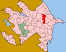
İkinci Çağan
From Wikipedia, the free encyclopedia
Coordinates: 40°43′53″N 48°32′54″E / 40.73139°N 48.54833°E
| İkinci Çağan | |
|---|---|
 İkinci Çağan | |
| Coordinates: 40°43′53″N 48°32′54″E / 40.73139°N 48.54833°E | |
| Country |
|
| Rayon | Shamakhi |
| Municipality | Çağan |
| Time zone | AZT (UTC+4) |
| • Summer (DST) | AZT (UTC+5) |
İkinci Çağan (also, Chagan Vtoroy, Chagan Vtoroye, and Chagan-Mimed-Salim) is The village forms part of the municipality of Çağan.[1]
References
This article is issued from Wikipedia. The text is available under the Creative Commons Attribution/Share Alike; additional terms may apply for the media files.
