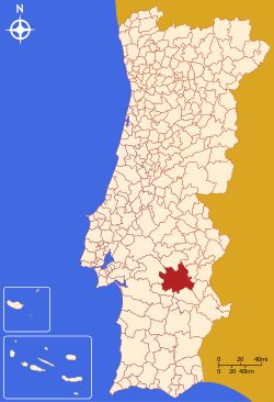
Évora Municipality
| Évora | |||
|---|---|---|---|
| Municipality | |||
 | |||
| |||
 | |||
| Coordinates: 38°34′N 07°54′W / 38.567°N 7.900°WCoordinates: 38°34′N 07°54′W / 38.567°N 7.900°W | |||
| Country |
| ||
| Region | Alentejo | ||
| Subregion | Alentejo Central | ||
| District/A.R. | Évora | ||
| Government | |||
| • Mayor | Carlos Pinto de Sá (CDU) | ||
| Area | |||
| • Total | 1,307.0 km2 (504.6 sq mi) | ||
| Population | |||
| • Total | 55,619 | ||
| • Density | 43/km2 (110/sq mi) | ||
| Parishes (no.) | 19 | ||
| Municipal holiday |
Saint Peter June 29 | ||
| Website | http://www.cm-evora.pt/cmevora | ||
Évora (Portuguese pronunciation: [ˈɛvuɾɐ] (![]() )) is a municipality in Portugal. It has total area of 1,307.0 km2 (505 sq mi) with a population of 55,619 inhabitants. It is the seat of the Évora District and capital of the Alentejo region. The municipality is composed of 19 civil parishes, and is located in Évora District.
)) is a municipality in Portugal. It has total area of 1,307.0 km2 (505 sq mi) with a population of 55,619 inhabitants. It is the seat of the Évora District and capital of the Alentejo region. The municipality is composed of 19 civil parishes, and is located in Évora District.
It contains the city of Évora.
The present Mayor is Carlos Pinto de Sá of the CDU coalition. The municipal holiday is June 29.
Geography
Physical geography
Évora (latitude 38.33º, longitude 7º57', altitude 300 m) is situated in Alentejo (southern Portugal). It is the chief city of the district. The seat of the municipality is the city of Évora, composed by the civil parishes of Santo Antão, São Mamede and Sé e São Pedro in the historical centre and the urban parishes of Bacelo, Horta das Figueiras, Malagueira and Senhora da Saúde outside the ancient city walls where most of the population in fact reside. The remaining civil parishes in the municipality are rural or suburban and do not form part of the city for statistic purposes.
The freeway that serves Évora is the A6/E90. The municipality can be reached by the following motor routes:
- from Lisbon, take the 25 de Abril Bridge, then the A2 and the A6
- or take the Vasco da Gama Bridge, then the A12, A2 and A6
- from Setúbal, take the IC3, then join the A2 and take the A6
- from Elvas or Spain (Badajoz), take the A6
- from the interior north and center, take the A23 (free), then the IP2; if you want freeway only, (IP2 being a highway) take the A23 (free), then the A1 to Santarém, where you will cross the Tagus river, then A13 and A6.
Travel time from Lisbon by car (due east) via the toll road[A6] is about one and a half hours. Secondary, scenic roads can be taken, but the trip time is much longer (up to 3 hours). Due to a limited amount of tourist signs, a list of interesting points compiled prior to driving a route to Évora is important. Motor assistance services are reasonable but aimed at local commerce, not tourism.
Climate
The weather tends to be warm and often hot (32-35°C), and rarely goes below 5 °C (41 °F) in winter.
| |||||||||||||||||||||||||||||||||||||||||||||||||||||||||||||||||||||||||||||||||||||||||||||||||||||||||||||||||||||||||||||
Human geography
Évora is in the heart of Alentejo region, an area consisting mostly of a soft rolling hills and plains. Alentejo's capital and largest city, Évora is a quite pleasant medium sized city and has numerous monuments. Due to its long history, monuments and buildings are its main attraction to outsiders. However there are numerous "Festas Populares" celebrating saints, holidays, "Feiras" (fairs) and cultural events (such as televised musical presentations) sponsored by the municipality and other organizations[1] Such events are so common that locals hardly make reference to them. The city's wonderful backdrop is often featured in concerts.
The municipality consists of 19 civil parishes.
Economy
Évora is the chief city of the Alentejo region, and plays a role as an important agricultural and services center. It is home to several institutions with great importance for the region, like the state-run University of Évora and district hospital. Évora has tried to develop the aerospace sector, and expects soon Embraer industrial facilities.[2]
Évora, as well as the surrounding area, has many hotel, bed-and-breakfast and various styles of accommodation. From the very expensive - Convento do Espinheiro, Heritage Hotel & Spa - to camping sites, there is a great variety, with something for all tastes and budgets.
Transport
Évora can also be reached by bus or train. The construction of a high speed train link to Lisbon and Madrid is planned.
There is a small airfield, the Évora Municipal Airport, currently without commercial airline service. The closest major airports are: Beja, Lisbon, Faro and Badajoz.
References
- Notes
- ↑ Região de Turismo de Évora in Portuguese.
- ↑ (Portuguese)Évora aprova isenções fiscais aos projectos da Embraer, Diário Digital (22 August 2008)
- Sources
- Turner, J. - Grove Dictionary of Art - MacMillan Publishers Ltd., 1996; ISBN 0-19-517068-7
- The Rough Guide to Portugal - 11th edition March 2005 - ISBN 1-84353-438-X
- Rentes de Carvalho J. - Portugal, um guia para amigos - In Dutch translation : Portugal - De Arbeiderspers, Amsterdam; ninth edition August 1999 ISBN 90-295-3466-4
External links
| Wikimedia Commons has media related to Évora. |
- Town Hall official website
- Évora´s Article by Gina Modesto in Accessible Travel Magazine, October 2007 (Error 404 2009-6-4)
- Map of Évora
- Évora Bilíngue PT/BG
| |||||

