Çengelköy
| Çengelköy | |
|---|---|
| Neighborhood | |
 Çengelköy | |
| Coordinates: 41°02′57″N 29°03′43″E / 41.04913°N 29.06201°ECoordinates: 41°02′57″N 29°03′43″E / 41.04913°N 29.06201°E | |
| Country |
|
| Region | Marmara |
| Province | Istanbul |
| District | Üsküdar |
| Time zone | EET (UTC+2) |
| • Summer (DST) | EEST (UTC+3) |
| Postal code | 34680 |
| Area code | 0-216 |
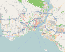
Çengelköy is a neighborhood in the Üsküdar district on the Asian shore of the Bosphorus, in Istanbul, Turkey, between the neighborhoods of Beylerbeyi and Kuleli. It is mainly a residential district. Many mansions were built there in the Ottoman period.
From the 6th century, the port of Çengelköy was called Sophianai because of the palace Justin II built nearby for his consort Sophia.[1]
The name Çengelköy means "hook village", and indeed the village is nestled around a sharp turn of the Bosphorus shore,[citation needed] but the origin of the name is uncertain. One story put forward is that the village is named after the 19th-century Ottoman admiral Çengeloğlu Tahir Pasha, who had a waterside mansion built there (and there is a Çengeloğlu Street in Çengelköy). Another story derives the name from the Persian word çenkar, "crab," because of the abundance of seafood in the Bosphorus there.[2] A 16th-century Ottoman document apparently refers to the place as "Çenger köyü."[3]
Çengelköy is world-famous for the small cucumbers once grown there (now grown in Kandıra).
Notes
References
- Falling Rain Genomics, Inc. "Geographical information on Çengelköy, Istanbul". Retrieved 2008-11-22.
- Printed sources
- Belge, Murat (1993). İstanbul Gezi Rehberi (in Turkish). Tarih Vakfı Yurt Yayınları. ISBN 978-975-333-002-2. Retrieved 2008-11-22.
- Eyice, Semavi (1976). Bizans Devrinde Boğaziçi. Edebiyat Fakültesi Basımevi.
- Hürel, Haldun (2008). Semtleri, Mahalleri, Caddeleri ve Sokakları A'dan Z'ye İstanbul'un Alfabetik Öyküsü. İkarus. ISBN 978-975-999-290-3.
| ||||||||