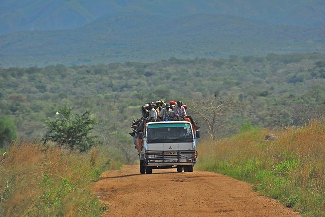
File:Road between Fort Portal and Rebisengo - Flickr - Dave Proffer (7).jpg

Size of this preview: 640 × 428 pixels.
| |
This is a file from the Wikimedia Commons. Information from its description page there is shown below.
Commons is a freely licensed media file repository. You can help. |
| Description | Road between Fort Portal and Rebisengo |
| Date | 28 March 2007, 15:40 |
| Source | Road between Fort Portal and Rebisengo |
| Author | Dave Proffer |
|
Camera location |
0° 58′ 6.60″ N, 30° 19′ 13.20″ E |
This and other images at their locations on: Google Maps - Google Earth - OpenStreetMap | ( Info)0.9685;30.320333 |
|---|
Licensing
| This file is licensed under the Creative Commons Attribution 2.0 Generic license. | ||
http://creativecommons.org/licenses/by/2.0 CC-BY-2.0 Creative Commons Attribution 2.0 truetrue |
| This image was originally posted to Flickr by Dave Proffer at http://flickr.com/photos/23442653@N00/464011874. It was reviewed on 21 January 2012 by the FlickreviewR robot and was confirmed to be licensed under the terms of the cc-by-2.0. |
File usage
The following pages on Schools Wikipedia link to this image (list may be incomplete):
Metadata
This file contains additional information, probably added from the digital camera or scanner used to create or digitize it. If the file has been modified from its original state, some details may not fully reflect the modified file.
| Camera manufacturer | NIKON CORPORATION |
|---|---|
| Camera model | NIKON D200 |
| Exposure time | 1/640 sec (0.0015625) |
| F-number | f/5.6 |
| ISO speed rating | 100 |
| Date and time of data generation | 15:40, 28 March 2007 |
| Lens focal length | 200 mm |
| Latitude | 0° 58′ 6.6″ N |
| Longitude | 30° 19′ 13.2″ E |
| Altitude | 684 meters above sea level |
| Horizontal resolution | 72 dpi |
| Vertical resolution | 72 dpi |
| Software used | Ver.2.00 |
| File change date and time | 15:40, 28 March 2007 |
| Exposure Program | Shutter priority |
| Exif version | 2.21 |
| Date and time of digitizing | 15:40, 28 March 2007 |
| Image compression mode | 4 |
| Exposure bias | 0 |
| Maximum land aperture | 5 APEX (f/5.66) |
| Metering mode | Pattern |
| Light source | Unknown |
| Flash | Flash did not fire |
| DateTime subseconds | 24 |
| DateTimeOriginal subseconds | 24 |
| DateTimeDigitized subseconds | 24 |
| Supported Flashpix version | 0,100 |
| Colour space | sRGB |
| Sensing method | One-chip colour area sensor |
| Custom image processing | Normal process |
| Exposure mode | Auto exposure |
| White balance | Auto white balance |
| Digital zoom ratio | 1 |
| Focal length in 35 mm film | 300 mm |
| Scene capture type | Standard |
| Scene control | None |
| Contrast | Normal |
| Saturation | High saturation |
| Sharpness | Hard |
| Subject distance range | Unknown |
| Geodetic survey data used | WGS-84 |
| GPS tag version | 2.2.0.0 |
| IIM version | 2 |
| Keywords |
|
| Country shown | Uganda |
Want to know more?
Wikipedia for Schools is one of SOS Childrens Villages' many educational projects. SOS Children believes that a decent childhood is essential to a happy, healthy. Our community work brings families new opportunities through education, healthcare and all manner of support. Find out how you can help children in other countries.
