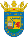
Álava
| Álava Araba |
|||
|---|---|---|---|
| — Province — | |||
|
|||
 |
|||
| Country | |||
| Autonomous Community | |||
| Capital | Vitoria-Gasteiz | ||
| Government | |||
| - Deputy General | Xabier Agirre (EAJ-PNV) | ||
| Area | |||
| - Total | 2,963 km2 (1,144 sq mi) | ||
| Population (2009) | |||
| - Total | 313,819 | ||
| - Density | 105.9/km2 (274.3/sq mi) | ||
| - Ranked | 41 | ||
| - Percent | 0.68% | ||
| Official languages | Basque, Spanish | ||
| Parliament | Cortes Generales | ||
| Congress seats | 4 | ||
| Senate seats | 4 | ||
| Juntas Generales de Álava | 51 | ||
| Website | Arabako Foru Aldundia | ||
Álava (Basque: Araba and officially Álava-Araba) is a province of northern Spain in the southern part of the Basque Autonomous Community. It is bordered by the provinces of Burgos (W), La Rioja (S), Navarre (E), Gipuzkoa (NE) and Biscay (NW). The County of Treviño is an exclave of the province of Burgos (Castile and León) surrounded by Alavese land, although there is strong local support for Treviño's incorporation into Álava and the Basque Autonomous Community.
Contents |
Demography and rural landscape
The province numbers 51 municipalities, a population of 315,5256 inhabitants in an area of 3,037 km2 (1,173 sq mi), with an average of 104,50 inhab/km².[1] The vast majority of the population clusters in the capital city of Álava Vitoria-Gasteiz (Vitoria is the Spanish name, Gasteiz the Basque name), which also serves as the capital of the Autonomous Community, but the remainder of the territory is sparsely inhabited with population nuclei distributed into seven counties (cuadrillas): Añana; Ayala; Campezo; Laguardia; Salvatierra; Vitoria-Gasteiz; Zuya.
Physical and human geography
Álava is an inland territory and features a largely transitional climate between the humid, Atlantic neighbouring northern provinces and the dry and warmer lands south of the Ebro River. According to the relief and landscape characteristics, the territory is divided into five main zones:
- The Gorbea Foothills: Green hilly landscape.
- The Valleys: Low valleys, drier, sparsely populated.
- The Plains: Heartland of Álava comprising Vitoria and Salvatierra-Agurain, with a central urban area and crop landscape prevailing around and bounded south and north by the Basque Mountains.
- The Alavese Mountains: Higher forest lands.
- The Alavese Rioja: Oriented to the south on the left bank of the Ebro River, perfect for vineyards.
- Ayala: The area clustering around the Nervión River, with Amurrio and Laudio as its major towns. The region shows close bonds with Bilbao and Biscaye and an industrial landscape.
Unlike Biscaye and Gipuzkoa, but for Ayala and Aramaio, the waters of Álava pour into the Ebro and hence to the Mediterranean by means of two main waterways, i.e. the Zadorra (main axis of Álava) and Bayas Rivers. In addition, the Zadorra Reservoir System harvests a big quantity of waters that supply not only the capital city but other major Basque towns and cities too (Bilbao, etc.).
While in 1950 agriculture and farming shaped the landscape of the territory (42.4% of the working force vs 30.5% in industry and construction), the trend shifted gradually during the 60s and 70s on the grounds of a growing industrial activity in the Alavese Plains (Llanada Alavesa), with the main focus lying on the industrial estates of Vitoria (Gamarra, Betoño and Ali Gobeo) and and, to a lesser extent, Salvatierra-Agurain and Araia. At the turn of the century, only 2% of the working Alavese people was in agriculture, while a 60% was in the third sector and 32% in manufacturing.[2] Industry associated to iron and metal developed earlier in the Atlantic area much in tune with Bilbao's economic dynamics, with droves of people flocking to and clustering in Amurrio and Laudio, which have since become the third and second main towns of Álava.
Lordship of Álava
List of rulers (original names):
- Rodrigo c.867–870, count of Castile
- Vela Jiménez 870–c.887
- Munio Velaz c.887–c.921
- Álvaro Herrameliz c.921–931, also count of Cerezo and Lantarón
- Fernán González 931–970, also count of Castile, Álava feudatary of Castile until 1030
- Munio González 1030–1043
- Fortunio Íñiguez 1043–1046
- Munio Muñoz (co-lord) 1046–1060, Álava feudatary of Navarre, 1046–1085
- Sancho Maceratiz (co-lord) 1046–1060
- Ramiro 1060–1075
- Marcelo 1075–1085
- Lope Íñiguez 1085–?, Álava feudatary of Castile until 1123
- Lope Díaz the White ?–1093
- Lope González 1093–1099
- Lope Sánchez 1099–1114
- Diego López I 1114–1123
- Ladrón Íñiguez 1123–1158, Álava feudatary of Navarre until 1199
- Vela Ladrón 1158–1175
- Juan Velaz 1175–1181
- Diego López II 1181–1187
- Íñigo de Oriz 1187–1199
- Diego López de Haro I 1199–1214, Álava feudatary of Castile until personal union of 1332
- Lope Diaz de Haro I 1214–1240
- Nuño González de Lara 1240–1252
- Diego López de Haro II 1252–1274
- Fernando de la Cerda 1274–1280
- Lope Díaz de Haro II 1280–1288
- Juan Alonso de Haro 1288–1310
- Diego López de Salcedo 1310–1332
The title is attributed to the Castilian kings after 1332.
Footnotes
- ↑ "Su población". Diputación Foral de Álava. http://www.alava.net/cs/Satellite?cid=1193046437725&pagename=DiputacionAlava%2FPage%2FDPA_contenidoFinal. Retrieved 2010-05-09. Text in Spanish
- ↑ "Su población". Diputación Foral de Álava. http://www.alava.net/cs/Satellite?cid=1193046437725&pagename=DiputacionAlava%2FPage%2FDPA_contenidoFinal. Retrieved 2010-05-09. Text in Spanish
See also
- Antoñana
- Basque Economic Agreement
- List of municipalities in Álava
|
|||||||
|
|||||||

